Buverchy
Buverchy is a commune in the Somme department in Hauts-de-France in northern France.
Buverchy | |
|---|---|
The town hall in Buverchy | |
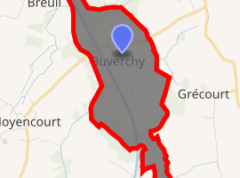
Location of Buverchy 
| |
 Buverchy  Buverchy | |
| Coordinates: 49°43′53″N 2°58′16″E | |
| Country | France |
| Region | Hauts-de-France |
| Department | Somme |
| Arrondissement | Péronne |
| Canton | Ham |
| Intercommunality | CC Est de la Somme |
| Government | |
| • Mayor (2001–2008) | Pierre Carpentier |
| Area 1 | 1.85 km2 (0.71 sq mi) |
| Population (2017-01-01)[1] | 49 |
| • Density | 26/km2 (69/sq mi) |
| Time zone | UTC+01:00 (CET) |
| • Summer (DST) | UTC+02:00 (CEST) |
| INSEE/Postal code | 80158 /80400 |
| Elevation | 56–64 m (184–210 ft) (avg. 61 m or 200 ft) |
| 1 French Land Register data, which excludes lakes, ponds, glaciers > 1 km2 (0.386 sq mi or 247 acres) and river estuaries. | |
Geography
Buverchy is situated on the D154 road, some 18 miles (29 km) southeast of Saint-Quentin.
Population
| Year | 1962 | 1968 | 1975 | 1982 | 1990 | 1999 | 2006 |
|---|---|---|---|---|---|---|---|
| Population | 16 | 37 | 35 | 36 | 50 | 43 | 41 |
| From the year 1962 on: No double counting—residents of multiple communes (e.g. students and military personnel) are counted only once. | |||||||
gollark: > also can you please pm me the connection finder tool (you write the username and it finds accounts of the same person on other sites)ħħħħħ
gollark: Inconveniently enough, both of them rely heavily on mutable state and are hard to test.
gollark: https://github.com/TomSmeets/FractalArt/blob/master/src/Main.hs vs https://pastebin.com/diwDBnvA.
gollark: I don't know either. I mostly ported it from Haskell and guessed roughly what each bit did.
gollark: See, I don't mind the bit which is green as much as the fact that it still randomly includes purpley blotches.
See also
References
- "Populations légales 2017". INSEE. Retrieved 6 January 2020.
| Wikimedia Commons has media related to Buverchy. |
This article is issued from Wikipedia. The text is licensed under Creative Commons - Attribution - Sharealike. Additional terms may apply for the media files.