Saint-Sauveur, Somme
Saint-Sauveur is a commune in the Somme department in Hauts-de-France in northern France.
Saint-Sauveur | |
|---|---|
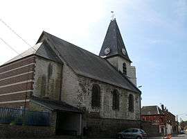 The church in Saint-Sauveur | |
Location of Saint-Sauveur 
| |
 Saint-Sauveur  Saint-Sauveur | |
| Coordinates: 49°56′18″N 2°12′42″E | |
| Country | France |
| Region | Hauts-de-France |
| Department | Somme |
| Arrondissement | Amiens |
| Canton | Ailly-sur-Somme |
| Intercommunality | CC Nièvre et Somme |
| Government | |
| • Mayor (2001–2008) | Gilles Delattre |
| Area 1 | 9.04 km2 (3.49 sq mi) |
| Population (2017-01-01)[1] | 1,376 |
| • Density | 150/km2 (390/sq mi) |
| Time zone | UTC+01:00 (CET) |
| • Summer (DST) | UTC+02:00 (CEST) |
| INSEE/Postal code | 80718 /80470 |
| Elevation | 12–84 m (39–276 ft) (avg. 45 m or 148 ft) |
| 1 French Land Register data, which excludes lakes, ponds, glaciers > 1 km2 (0.386 sq mi or 247 acres) and river estuaries. | |
Geography
The commune is situated 3 miles (5 km) northwest of Amiens, at the D191 and D97 crossroads, by the banks of the Somme River
Population
| 1962 | 1968 | 1975 | 1982 | 1990 | 1999 | 2006 |
|---|---|---|---|---|---|---|
| 1034 | 1173 | 1371 | 1410 | 1557 | 1526 | 1427 |
| Starting in 1962: Population without duplicates | ||||||
gollark: Anyway, the internet is complicated and has complicated effects and I don't think it is practical or sane to go "it's good" or "it's bad".
gollark: People blame obesity on lots of things: food changes, chemical contaminants of some sort, people doing less physical activity (which is not entirely due to the internet).
gollark: Nonrandom number generator.
gollark: That's an assumption and 0.75.
gollark: Other than that, I like being able to look up things conveniently and talk to people who are not physically nearby, which is most of them.
See also
References
- "Populations légales 2017". INSEE. Retrieved 6 January 2020.
| Wikimedia Commons has media related to Saint-Sauveur (Somme). |
| Authority control |
|
|---|
This article is issued from Wikipedia. The text is licensed under Creative Commons - Attribution - Sharealike. Additional terms may apply for the media files.