Warsy
Warsy is a commune in the Somme department in Hauts-de-France in northern France.
Warsy | |
|---|---|
_France.JPG) The town hall and school in Warsy | |
Location of Warsy 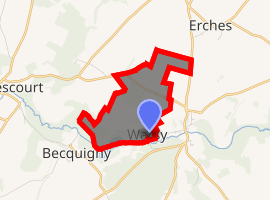
| |
 Warsy  Warsy | |
| Coordinates: 49°42′00″N 2°38′58″E | |
| Country | France |
| Region | Hauts-de-France |
| Department | Somme |
| Arrondissement | Montdidier |
| Canton | Roye |
| Intercommunality | Grand Roye |
| Government | |
| • Mayor (2014-2020) | Christophe Dumont |
| Area 1 | 2.98 km2 (1.15 sq mi) |
| Population (2017-01-01)[1] | 143 |
| • Density | 48/km2 (120/sq mi) |
| Time zone | UTC+01:00 (CET) |
| • Summer (DST) | UTC+02:00 (CEST) |
| INSEE/Postal code | 80822 /80500 |
| Elevation | 52–105 m (171–344 ft) (avg. 100 m or 330 ft) |
| 1 French Land Register data, which excludes lakes, ponds, glaciers > 1 km2 (0.386 sq mi or 247 acres) and river estuaries. | |
Geography
Warsy is situated 22 miles(35 km) southeast of Amiens, just off the D329 road
Population
| Year | Pop. | ±% |
|---|---|---|
| 2006 | 117 | — |
| 2007 | 118 | +0.9% |
| 2008 | 114 | −3.4% |
| 2009 | 116 | +1.8% |
| 2010 | 119 | +2.6% |
| 2011 | 123 | +3.4% |
| 2012 | 127 | +3.3% |
| 2013 | 129 | +1.6% |
| 2014 | 129 | +0.0% |
| 2015 | 141 | +9.3% |
| 2016 | 142 | +0.7% |
Places of interest
- The château of Warsy. http://www.warsy.com/
- The nineteenth century church.
- The old public wash-house (no longer functioning).
- The Second World War memorial.
- An old school, not used since the 1960s.
- The mairie.
gollark: Social networks without E2E don't say "yes, we're not very secure, but [list of features that that allows us to provide we couldn't otherwise]".
gollark: That never happens.
gollark: I only really do software, hardware is expensive and slower to iterate on.
gollark: I mean, sure, it wouldn't exist without users abstractly speaking, but some users are just bad and wrong.
gollark: Except the mobile phone system, which seems to be a horrible convoluted insecure mess.
See also
External links
| Wikimedia Commons has media related to Warsy. |
- Warsy on the Quid website (in French)
| Authority control |
|
|---|
This article is issued from Wikipedia. The text is licensed under Creative Commons - Attribution - Sharealike. Additional terms may apply for the media files.