Senarpont
Senarpont is a commune in the Somme department and Hauts-de-France region of northern France.
Senarpont | |
|---|---|
The Place du General Leclerc | |
.svg.png) Coat of arms | |
Location of Senarpont 
| |
 Senarpont  Senarpont | |
| Coordinates: 49°53′24″N 1°43′07″E | |
| Country | France |
| Region | Hauts-de-France |
| Department | Somme |
| Arrondissement | Amiens |
| Canton | Poix-de-Picardie |
| Intercommunality | CC Somme Sud-Ouest |
| Government | |
| • Mayor (2014–2020) | Béatrice Delhomelle |
| Area 1 | 7 km2 (3 sq mi) |
| Population (2017-01-01)[1] | 647 |
| • Density | 92/km2 (240/sq mi) |
| Time zone | UTC+01:00 (CET) |
| • Summer (DST) | UTC+02:00 (CEST) |
| INSEE/Postal code | 80732 /80140 |
| Elevation | 61–177 m (200–581 ft) (avg. 80 m or 260 ft) |
| 1 French Land Register data, which excludes lakes, ponds, glaciers > 1 km2 (0.386 sq mi or 247 acres) and river estuaries. | |
Geography
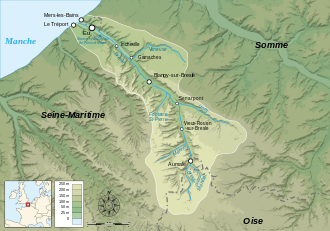
Senarpont is situated at the confluence of the rivers Liger and Bresle some 42 km west of Amiens, on the D1015 road.

Senarpont at the confluence of the rivers Liger and Bresle
Population
| 1962 | 1968 | 1975 | 1982 | 1990 | 1999 | 2006 | 2014 |
|---|---|---|---|---|---|---|---|
| 515 | 635 | 727 | 769 | 800 | 770 | 737 | 666 |
| Starting in 1962: Population without duplicates | |||||||
gollark: I've found this alternative tool (https://github.com/Benjamin-Dobell/luabundler) which might work too, hmm.
gollark: Oh, neat.
gollark: Well, I ctrl+Fed it and it seems to contain CC FS calls.
gollark: Can you run it without having to use a CC emulator or something?
gollark: Hmm. It seems like it's designed to run in CC. This is troubling.
See also
References
- "Populations légales 2017". INSEE. Retrieved 6 January 2020.
| Wikimedia Commons has media related to Senarpont. |
This article is issued from Wikipedia. The text is licensed under Creative Commons - Attribution - Sharealike. Additional terms may apply for the media files.