Morisel
Morisel is a commune in the Somme department in Hauts-de-France in northern France.
Morisel | |
|---|---|
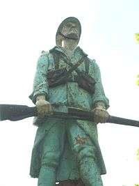 The war memorial in Morisel | |
Location of Morisel 
| |
 Morisel  Morisel | |
| Coordinates: 49°46′13″N 2°28′33″E | |
| Country | France |
| Region | Hauts-de-France |
| Department | Somme |
| Arrondissement | Montdidier |
| Canton | Moreuil |
| Intercommunality | CC Avre Luce Noye |
| Government | |
| • Mayor (2006–2008) | Claude Flamand |
| Area 1 | 6.43 km2 (2.48 sq mi) |
| Population (2017-01-01)[1] | 518 |
| • Density | 81/km2 (210/sq mi) |
| Time zone | UTC+01:00 (CET) |
| • Summer (DST) | UTC+02:00 (CEST) |
| INSEE/Postal code | 80571 /80110 |
| Elevation | 32–109 m (105–358 ft) (avg. 43 m or 141 ft) |
| 1 French Land Register data, which excludes lakes, ponds, glaciers > 1 km2 (0.386 sq mi or 247 acres) and river estuaries. | |
Geography
Morisel is situated on the D920 road, some 15 miles (24 km) southeast of Amiens on the banks of the river Avre.
Population
| 1962 | 1968 | 1975 | 1982 | 1990 | 1999 | 2006 |
|---|---|---|---|---|---|---|
| 430 | 455 | 443 | 451 | 430 | 429 | 533 |
| Starting in 1962: Population without duplicates | ||||||
gollark: Though I think theirs is compiled from non-hundred-thousand line files.
gollark: I mean, SQLite does that and it works for *them*, but it also means they have a hundred thousand line C file.
gollark: ÆÆÆÆÆÆÆÆÆÆÆÆÆÆÆÆÆ
gollark: This is important because having to do everything yourself is uncool.
gollark: Packaging is a thing because people want to use other people's code.
See also
References
- "Populations légales 2017". INSEE. Retrieved 6 January 2020.
| Wikimedia Commons has media related to Morisel. |
| Authority control |
|
|---|
This article is issued from Wikipedia. The text is licensed under Creative Commons - Attribution - Sharealike. Additional terms may apply for the media files.