Maucourt, Somme
Maucourt is a commune in the Somme department and Hauts-de-France region of northern France.
Maucourt | |
|---|---|
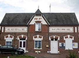
 The town hall in Maucourt | |
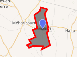
Location of Maucourt 
| |
 Maucourt  Maucourt | |
| Coordinates: 49°47′39″N 2°45′19″E | |
| Country | France |
| Region | Hauts-de-France |
| Department | Somme |
| Arrondissement | Péronne |
| Canton | Moreuil |
| Intercommunality | CC Terre de Picardie |
| Government | |
| • Mayor (2014–2020) | Fabrice Massias |
| Area 1 | 3.68 km2 (1.42 sq mi) |
| Population (2017-01-01)[1] | 180 |
| • Density | 49/km2 (130/sq mi) |
| Time zone | UTC+01:00 (CET) |
| • Summer (DST) | UTC+02:00 (CEST) |
| INSEE/Postal code | 80520 /80170 |
| Elevation | 86–94 m (282–308 ft) (avg. 91 m or 299 ft) |
| 1 French Land Register data, which excludes lakes, ponds, glaciers > 1 km2 (0.386 sq mi or 247 acres) and river estuaries. | |
Geography
Maucourt is situated on the D39 road, about 35 km east-south-east of Amiens.
Population
| 1946 | 1954 | 1962 | 1968 | 1975 | 1982 | 1990 | 1999 | 2006 | 2014 |
|---|---|---|---|---|---|---|---|---|---|
| 138 | 130 | 135 | 118 | 102 | 87 | 107 | 152 | 151 | 169 |
| Starting in 1962: Population without duplicates | |||||||||
gollark: Whatever units motionX/Y/Z are in.
gollark: `\fly h` to enable high power mode.
gollark: So ni-ctl carefully stays under it.
gollark: Of course, I do test these things, and it turns out that at a speed of 10 per something the server just zeroes your speed.
gollark: You can just use high power flight if ni-ctl is too slow.
See also
References
- "Populations légales 2017". INSEE. Retrieved 6 January 2020.
| Wikimedia Commons has media related to Maucourt (Somme). |
This article is issued from Wikipedia. The text is licensed under Creative Commons - Attribution - Sharealike. Additional terms may apply for the media files.