Taillet
Taillet (Catalan: Tellet) is a commune in the Pyrénées-Orientales department in southern France.
Taillet Tellet | |
|---|---|
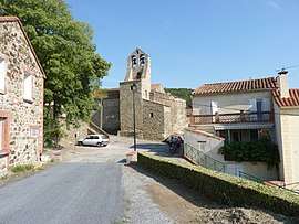 The church in the village of Taillet | |
Location of Taillet 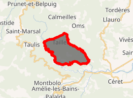
| |
 Taillet  Taillet | |
| Coordinates: 42°31′41″N 2°40′22″E | |
| Country | France |
| Region | Occitanie |
| Department | Pyrénées-Orientales |
| Arrondissement | Céret |
| Canton | Le Canigou |
| Government | |
| • Mayor (2008–2014) | Amédée Raymond |
| Area 1 | 10.02 km2 (3.87 sq mi) |
| Population (2017-01-01)[1] | 105 |
| • Density | 10/km2 (27/sq mi) |
| Time zone | UTC+01:00 (CET) |
| • Summer (DST) | UTC+02:00 (CEST) |
| INSEE/Postal code | 66199 /66400 |
| Elevation | 198–681 m (650–2,234 ft) (avg. 600 m or 2,000 ft) |
| 1 French Land Register data, which excludes lakes, ponds, glaciers > 1 km2 (0.386 sq mi or 247 acres) and river estuaries. | |
As of 2012 the population was 127.[2]
Geography
Taillet is located in the canton of Le Canigou and in the arrondissement of Céret.
The town is at the foot of the eastern end of the Pyrenees mountains, close to the border with the eastern tip of Spain, near the Mediterranean Sea. It mostly has lush forestland, some grazing land for animals and croplands.
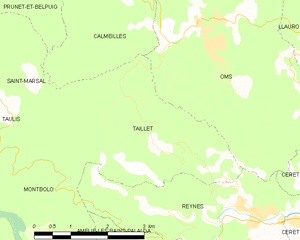
Map of Taillet and its surrounding communes
Population
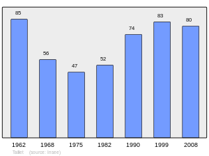
Population 1962-2008
gollark: Not everything I recommend is bad.
gollark: Yes, well.
gollark: <@184468521042968577> It's easy.
gollark: excellent. MWAHAHAHAHA!
gollark: It seems *not* to be. Could someone check?
References
- "Populations légales 2017". INSEE. Retrieved 6 January 2020.
- "Populations légales 2012 de la commune". INSEE. Retrieved 21 April 2015.
External links
| Wikimedia Commons has media related to Taillet. |
| Authority control |
|
|---|
This article is issued from Wikipedia. The text is licensed under Creative Commons - Attribution - Sharealike. Additional terms may apply for the media files.