Estoher
Estoher (Catalan: Estoer) is a commune in the Pyrénées-Orientales department in southern France.
Estoher Estoer | |
|---|---|
.jpg) A postcard view of Estoher, in the early 20th century | |
 Coat of arms | |
Location of Estoher 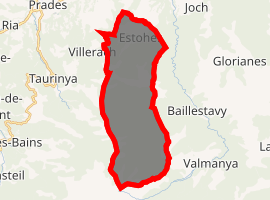
| |
 Estoher  Estoher | |
| Coordinates: 42°36′06″N 2°29′13″E | |
| Country | France |
| Region | Occitanie |
| Department | Pyrénées-Orientales |
| Arrondissement | Prades |
| Canton | Le Canigou |
| Intercommunality | Conflent Canigó |
| Government | |
| • Mayor (2014-2020) | Louis Ques |
| Area 1 | 26.08 km2 (10.07 sq mi) |
| Population (2017-01-01)[1] | 145 |
| • Density | 5.6/km2 (14/sq mi) |
| Time zone | UTC+01:00 (CET) |
| • Summer (DST) | UTC+02:00 (CEST) |
| INSEE/Postal code | 66073 /66320 |
| Elevation | 336–2,481 m (1,102–8,140 ft) (avg. 360 m or 1,180 ft) |
| 1 French Land Register data, which excludes lakes, ponds, glaciers > 1 km2 (0.386 sq mi or 247 acres) and river estuaries. | |
Geography
Localisation
Estoher is located in the canton of Le Canigou and in the arrondissement of Prades.
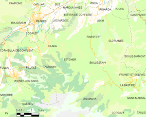
Map of Estoher and its surrounding communes
Neighbouring communes
Places adjacent to Estoher | |
|---|---|

Population
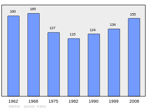
Population 1962-2008
gollark: Some are worse than others.
gollark: Besides, the growing trends toward unfreedom do not actually seem to be driven by things related to courts.
gollark: "yes, my server is perfectly secure as long as nobody does things I don't want them to to it"
gollark: Besides, I can hardly call a system exposed to untrusted user input "good" if it breaks badly if used in unintended ways.
gollark: The court system isn't flawless and perfect. It's some people's guess about what might be good several hundred years ago subject to some cultural evolution since.
References
- "Populations légales 2017". INSEE. Retrieved 6 January 2020.
| Wikimedia Commons has media related to Estoher. |
| Authority control |
|
|---|
This article is issued from Wikipedia. The text is licensed under Creative Commons - Attribution - Sharealike. Additional terms may apply for the media files.