Saint-Marsal
Saint-Marsal (Catalan: Sant Marçal) is a commune in the Pyrénées-Orientales department in southern France.
Saint-Marsal Sant Marçal | |
|---|---|
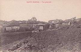 A postcard view of Saint-Marsal, in the early 20th century | |
Location of Saint-Marsal 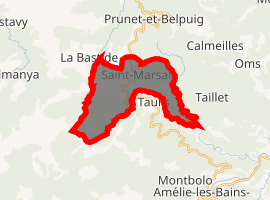
| |
 Saint-Marsal  Saint-Marsal | |
| Coordinates: 42°32′19″N 2°37′19″E | |
| Country | France |
| Region | Occitanie |
| Department | Pyrénées-Orientales |
| Arrondissement | Céret |
| Canton | Le Canigou |
| Intercommunality | Haut Vallespir |
| Government | |
| • Mayor (2008–2014) | Marguerite Dagues |
| Area 1 | 15.36 km2 (5.93 sq mi) |
| Population (2017-01-01)[1] | 71 |
| • Density | 4.6/km2 (12/sq mi) |
| Time zone | UTC+01:00 (CET) |
| • Summer (DST) | UTC+02:00 (CEST) |
| INSEE/Postal code | 66183 /66110 |
| Elevation | 260–1,477 m (853–4,846 ft) (avg. 720 m or 2,360 ft) |
| 1 French Land Register data, which excludes lakes, ponds, glaciers > 1 km2 (0.386 sq mi or 247 acres) and river estuaries. | |
Geography
Saint-Marsal is located in the canton of Le Canigou and in the arrondissement of Céret.
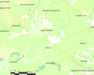
Map of Saint-Marsal and its surrounding communes
Population
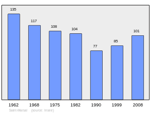
Population 1962-2008
gollark: (for nonevil reasons)
gollark: (bb)logging start
gollark: (bb)logging strt
gollark: How do I secretly hitler?
gollark: BUTTONS? Troubling.
References
- "Populations légales 2017". INSEE. Retrieved 6 January 2020.
| Wikimedia Commons has media related to Saint-Marsal. |
| Authority control |
|
|---|
This article is issued from Wikipedia. The text is licensed under Creative Commons - Attribution - Sharealike. Additional terms may apply for the media files.