Mosset
Mosset is a commune in the Pyrénées-Orientales department in southern France.
Mosset | |
|---|---|
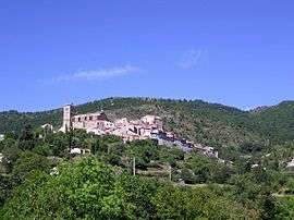 Mosset seen from the road to Campôme | |
Location of Mosset 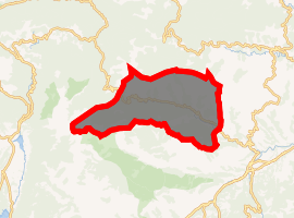
| |
 Mosset  Mosset | |
| Coordinates: 42°40′09″N 2°20′56″E | |
| Country | France |
| Region | Occitanie |
| Department | Pyrénées-Orientales |
| Arrondissement | Prades |
| Canton | Les Pyrénées catalanes |
| Government | |
| • Mayor (2008–2014) | Henri Sentenac |
| Area 1 | 71.93 km2 (27.77 sq mi) |
| Population (2017-01-01)[1] | 308 |
| • Density | 4.3/km2 (11/sq mi) |
| Time zone | UTC+01:00 (CET) |
| • Summer (DST) | UTC+02:00 (CEST) |
| INSEE/Postal code | 66119 /66500 |
| Elevation | 558–2,459 m (1,831–8,068 ft) (avg. 710 m or 2,330 ft) |
| 1 French Land Register data, which excludes lakes, ponds, glaciers > 1 km2 (0.386 sq mi or 247 acres) and river estuaries. | |
Geography
Mosset is located in the canton of Les Pyrénées catalanes and in the arrondissement of Prades.
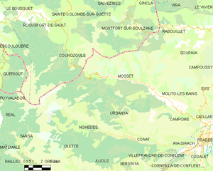
Map of Mosset and its surrounding communes
Population
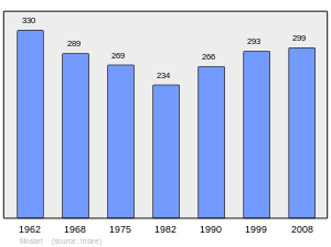
Population 1962-2008
gollark: Humans have many !!fun!! fallacies.
gollark: It's probably more sunk cost fallacy than actual Stockholm syndrome.
gollark: OOP bad, apioid.
gollark: Ah, I see.
gollark: What maths am I missing out on?
References
- "Populations légales 2017". INSEE. Retrieved 6 January 2020.
| Wikimedia Commons has media related to Mosset. |
| Authority control |
|
|---|
This article is issued from Wikipedia. The text is licensed under Creative Commons - Attribution - Sharealike. Additional terms may apply for the media files.