Mantet
Mantet (Catalan: Mentet) is a commune in the Pyrénées-Orientales department in southern France.
Mantet Mentet | |
|---|---|
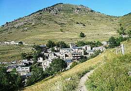 A general view of Mantet | |
 Coat of arms | |
Location of Mantet 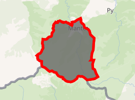
| |
 Mantet  Mantet | |
| Coordinates: 42°28′41″N 2°18′28″E | |
| Country | France |
| Region | Occitanie |
| Department | Pyrénées-Orientales |
| Arrondissement | Prades |
| Canton | Le Canigou |
| Government | |
| • Mayor (2001–2008) | Odile Guinel |
| Area 1 | 32.15 km2 (12.41 sq mi) |
| Population (2017-01-01)[1] | 30 |
| • Density | 0.93/km2 (2.4/sq mi) |
| Time zone | UTC+01:00 (CET) |
| • Summer (DST) | UTC+02:00 (CEST) |
| INSEE/Postal code | 66102 /66360 |
| Elevation | 1,381–2,688 m (4,531–8,819 ft) (avg. 1,558 m or 5,112 ft) |
| 1 French Land Register data, which excludes lakes, ponds, glaciers > 1 km2 (0.386 sq mi or 247 acres) and river estuaries. | |
Geography
Mantet is located in the canton of Le Canigou and in the arrondissement of Prades.
The village of Mantet lies at an altitude of 1550 metres about 200 metres below the Col de Mantet. The GR 10 Pyrenean footpath passes through the village so it is one of the few points in the Pyrenees Orientales where hikers can buy provisions and spend the night in comfort.
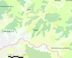
Map of Mantet and its surrounding communes
Population
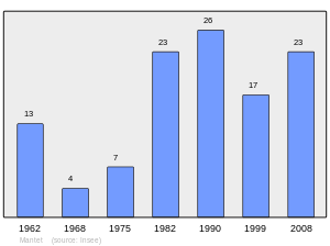
Population 1962-2008
gollark: Denied.
gollark: Yes, you can just rethingy z in terms of x and y.
gollark: For the rogue/warrior/mage one, say, you can define all of it in terms of Cartesian X/Y or your apious space-filling curve, but it's convenient if you treat it as three separate levels of mageness, warriorness and rogueness which add to 1 or something.
gollark: But, like with cubical coordinates for hex grids, the third dimension is more convenient when doing some things.
gollark: They don't have three... I think the word is linearly independent dimensions, no.
References
- "Populations légales 2017". INSEE. Retrieved 6 January 2020.
| Wikimedia Commons has media related to Mantet. |
| Authority control |
|
|---|
This article is issued from Wikipedia. The text is licensed under Creative Commons - Attribution - Sharealike. Additional terms may apply for the media files.