Glorianes
Glorianes is a commune in the Pyrénées-Orientales department in southern France.
Glorianes | |
|---|---|
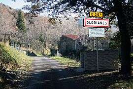 The city limit sign in Glorianes | |
Location of Glorianes 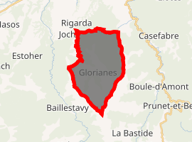
| |
 Glorianes  Glorianes | |
| Coordinates: 42°35′29″N 2°33′18″E | |
| Country | France |
| Region | Occitanie |
| Department | Pyrénées-Orientales |
| Arrondissement | Prades |
| Canton | Le Canigou |
| Government | |
| • Mayor (2008–2014) | Joseph Radondes |
| Area 1 | 18.72 km2 (7.23 sq mi) |
| Population (2017-01-01)[1] | 25 |
| • Density | 1.3/km2 (3.5/sq mi) |
| Time zone | UTC+01:00 (CET) |
| • Summer (DST) | UTC+02:00 (CEST) |
| INSEE/Postal code | 66086 /66320 |
| Elevation | 320–1,348 m (1,050–4,423 ft) (avg. 793 m or 2,602 ft) |
| 1 French Land Register data, which excludes lakes, ponds, glaciers > 1 km2 (0.386 sq mi or 247 acres) and river estuaries. | |
Geography
Glorianes is located in the canton of Le Canigou and in the arrondissement of Prades.
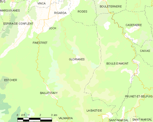
Map of Glorianes and its surrounding communes
Population
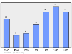
Population 1962-2008
gollark: I took a bunch of shortcuts by continuously `clone`ing things.
gollark: I may need to actually optimize the evaluator one of these years.
gollark: Which makes sense, but is really stupid.
gollark: Apparently this hangs it.
gollark: I might need to do some bees to make it work faster, because right now the evaluator is very not fast.
References
- "Populations légales 2017". INSEE. Retrieved 6 January 2020.
| Wikimedia Commons has media related to Glorianes. |
| Authority control |
|
|---|
This article is issued from Wikipedia. The text is licensed under Creative Commons - Attribution - Sharealike. Additional terms may apply for the media files.