Serdinya
Serdinya (Catalan: Serdinyà) is a commune in the Pyrénées-Orientales department in southern France.
Serdinya Serdinyà | |
|---|---|
Serdinya seen from Route nationale 116 | |
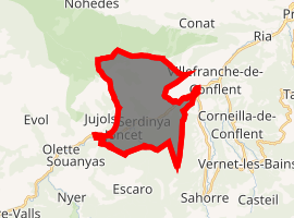
Location of Serdinya 
| |
 Serdinya  Serdinya | |
| Coordinates: 42°34′08″N 2°19′20″E | |
| Country | France |
| Region | Occitanie |
| Department | Pyrénées-Orientales |
| Arrondissement | Prades |
| Canton | Les Pyrénées catalanes |
| Government | |
| • Mayor (2008–2014) | Jean-Marie Maydat |
| Area 1 | 16.91 km2 (6.53 sq mi) |
| Population (2017-01-01)[1] | 246 |
| • Density | 15/km2 (38/sq mi) |
| Time zone | UTC+01:00 (CET) |
| • Summer (DST) | UTC+02:00 (CEST) |
| INSEE/Postal code | 66193 /66360 |
| Elevation | 449–1,792 m (1,473–5,879 ft) (avg. 530 m or 1,740 ft) |
| 1 French Land Register data, which excludes lakes, ponds, glaciers > 1 km2 (0.386 sq mi or 247 acres) and river estuaries. | |
Geography
Localisation
Serdinya is located in the canton of Les Pyrénées catalanes and in the arrondissement of Prades.

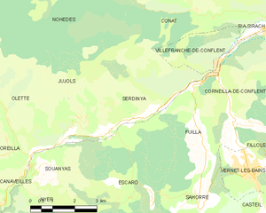
Map of Serdinya and its surrounding communes
Transport
Route nationale 116 (RN 116) connecting Perpignan and Bourg-Madame (near the Spanish and Andorran borders) passes through Serdinya.
Population

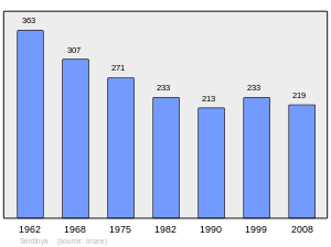
Population 1962-2008
gollark: Just stop considering orbital death rays a problem.Anyway, apparently the "federal reserve" is likely to increase interest rates some amount next year. Someone elsewhere said that that would probably be bad for the stock market. Is that accurate?
gollark: Yes, people are weird and want it for social status/scarcity/whatever rather than because it actually looks nice "inherently".
gollark: (also, I'm pretty sure IPFS doesn't guarantee that your file exists forever at no cost, someone has to be pinning it or viewing it)
gollark: It's probably irrelevant though, as I doubt *that* many people actually care about having the arbitrary ownership token™ in the first place and have the technical knowledge to check in much detail whether you actually do have it.
gollark: Smart contracts *have* been known to have complex bugs which are also completely impossible to patch after they've been released onto an unsuspecting public.
References
- "Populations légales 2017". INSEE. Retrieved 6 January 2020.
| Wikimedia Commons has media related to Serdinya. |
This article is issued from Wikipedia. The text is licensed under Creative Commons - Attribution - Sharealike. Additional terms may apply for the media files.