Fontrabiouse
Fontrabiouse (Catalan: Font Rabiosa) is a commune in the Pyrénées-Orientales department in southern France.
Fontrabiouse Font Rabiosa | |
|---|---|
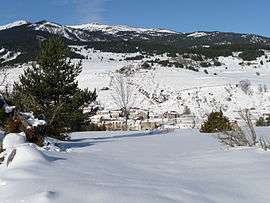 A general view of Fontrabiouse in the snow | |
Location of Fontrabiouse 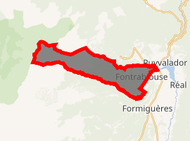
| |
 Fontrabiouse  Fontrabiouse | |
| Coordinates: 42°38′13″N 2°05′48″E | |
| Country | France |
| Region | Occitanie |
| Department | Pyrénées-Orientales |
| Arrondissement | Prades |
| Canton | Les Pyrénées catalanes |
| Intercommunality | Capcir Haut-Conflent |
| Government | |
| • Mayor (2008–2014) | Pierre Bataille |
| Area 1 | 15.57 km2 (6.01 sq mi) |
| Population (2017-01-01)[1] | 127 |
| • Density | 8.2/km2 (21/sq mi) |
| Time zone | UTC+01:00 (CET) |
| • Summer (DST) | UTC+02:00 (CEST) |
| INSEE/Postal code | 66081 /66210 |
| Elevation | 1,438–2,547 m (4,718–8,356 ft) (avg. 1,460 m or 4,790 ft) |
| 1 French Land Register data, which excludes lakes, ponds, glaciers > 1 km2 (0.386 sq mi or 247 acres) and river estuaries. | |
Geography
Fontrabiouse is located in the canton of Les Pyrénées catalanes and in the arrondissement of Prades.
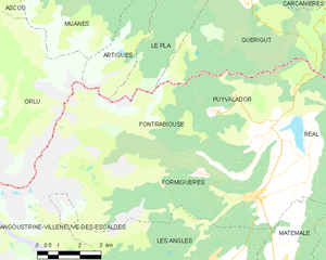
Map of Fontrabiouse and its surrounding communes
Population
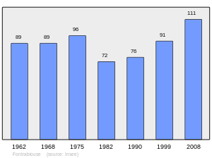
Population 1962-2008
gollark: Use UTF-64, for extensibility.
gollark: Probably just any which don't explicitly specify pointers/finite sizes anywhere.
gollark: Interesting. How do I connect a regex to ethernet and USB?
gollark: Just download more RAM...
gollark: I could ban string arithmetic in potatOS for type safety reasons.
References
- "Populations légales 2017". INSEE. Retrieved 6 January 2020.
| Wikimedia Commons has media related to Fontrabiouse. |
| Authority control |
|
|---|
This article is issued from Wikipedia. The text is licensed under Creative Commons - Attribution - Sharealike. Additional terms may apply for the media files.