Espira-de-Conflent
Espira-de-Conflent (Catalan: Espirà de Conflent) is a commune in the Pyrénées-Orientales department in southern France.
Espira-de-Conflent Espirà de Conflent | |
|---|---|
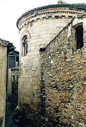 The church of Sainte-Marie, in Espira-de-Conflent | |
Location of Espira-de-Conflent 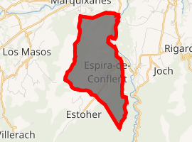
| |
 Espira-de-Conflent  Espira-de-Conflent | |
| Coordinates: 42°37′05″N 2°29′56″E | |
| Country | France |
| Region | Occitanie |
| Department | Pyrénées-Orientales |
| Arrondissement | Prades |
| Canton | Le Canigou |
| Intercommunality | Conflent Canigó |
| Government | |
| • Mayor (2014-20) | Roger-François Paillès |
| Area 1 | 6.03 km2 (2.33 sq mi) |
| Population (2017-01-01)[1] | 168 |
| • Density | 28/km2 (72/sq mi) |
| Time zone | UTC+01:00 (CET) |
| • Summer (DST) | UTC+02:00 (CEST) |
| INSEE/Postal code | 66070 /66320 |
| Elevation | 260–767 m (853–2,516 ft) (avg. 330 m or 1,080 ft) |
| 1 French Land Register data, which excludes lakes, ponds, glaciers > 1 km2 (0.386 sq mi or 247 acres) and river estuaries. | |
Geography
Localisation
Espira-de-Conflent is located in the canton of Le Canigou and in the arrondissement of Prades.
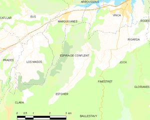
Map of Espira-de-Conflent and its surrounding communes
Neighbouring communes
Places adjacent to Espira-de-Conflent | |
|---|---|

Population
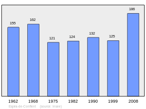
Population 1962-2008
gollark: ddg!eso Brotlipython
gollark: I have PRODUCED ESOLANG:
gollark: !quote 740909409378762812
gollark: !quote 741570646760488980
gollark: A beesolang, if you will.
References
- "Populations légales 2017". INSEE. Retrieved 6 January 2020.
| Wikimedia Commons has media related to Espira-de-Conflent. |
| Authority control |
|
|---|
This article is issued from Wikipedia. The text is licensed under Creative Commons - Attribution - Sharealike. Additional terms may apply for the media files.