Lamanère
Lamanère (Catalan: La Menera) is a commune in the Pyrénées-Orientales department in southern France.
Lamanère La Menera | |
|---|---|
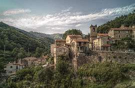 A general view of Lamanère | |
.svg.png) Coat of arms | |
Location of Lamanère 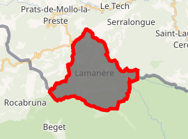
| |
 Lamanère  Lamanère | |
| Coordinates: 42°21′40″N 2°31′16″E | |
| Country | France |
| Region | Occitanie |
| Department | Pyrénées-Orientales |
| Arrondissement | Céret |
| Canton | Le Canigou |
| Intercommunality | Haut Vallespir |
| Government | |
| • Mayor (2008–2014) | Agnès Parayre |
| Area 1 | 23.83 km2 (9.20 sq mi) |
| Population (2017-01-01)[1] | 46 |
| • Density | 1.9/km2 (5.0/sq mi) |
| Time zone | UTC+01:00 (CET) |
| • Summer (DST) | UTC+02:00 (CEST) |
| INSEE/Postal code | 66091 /66230 |
| Elevation | 667–1,554 m (2,188–5,098 ft) (avg. 780 m or 2,560 ft) |
| 1 French Land Register data, which excludes lakes, ponds, glaciers > 1 km2 (0.386 sq mi or 247 acres) and river estuaries. | |
It is the southernmost village of Continental France.
Geography
Lamanère is located in the canton of Le Canigou and in the arrondissement of Céret.
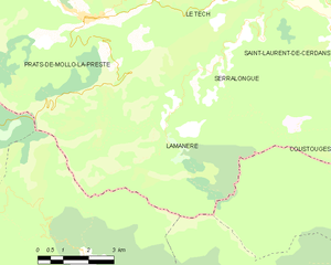
Map of Lamanère and its surrounding communes
Population
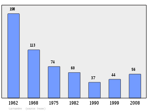
Population 1962-2008
gollark: You just commented on it.
gollark: I wonder why they reacted so strongly to the execution of COMPARTMENTAL SLATS.
gollark: Wait, *can* I contact him? They're not on here.
gollark: I see.
gollark: You removed the "she/her trial" thing so I reserve the right to use real-world-thingied pronouns.
See also
- Communes of the Pyrénées-Orientales department
- Bray-Dunes, the northernmost commune of Continental France
References
- "Populations légales 2017". INSEE. Retrieved 6 January 2020.
| Wikimedia Commons has media related to Lamanère (Pyrénées-Orientales). |
| Authority control |
|---|
This article is issued from Wikipedia. The text is licensed under Creative Commons - Attribution - Sharealike. Additional terms may apply for the media files.