L'Étoile, Somme
L'Étoile is a commune in the Somme department in Hauts-de-France in northern France.
L'Étoile | |
|---|---|
 Coat of arms | |
Location of L'Étoile 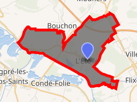
| |
 L'Étoile  L'Étoile | |
| Coordinates: 50°01′28″N 2°01′58″E | |
| Country | France |
| Region | Hauts-de-France |
| Department | Somme |
| Arrondissement | Amiens |
| Canton | Flixecourt |
| Intercommunality | CC Nièvre et Somme |
| Government | |
| • Mayor (2001–2008) | Alain Castello |
| Area 1 | 7.9 km2 (3.1 sq mi) |
| Population (2017-01-01)[1] | 1,194 |
| • Density | 150/km2 (390/sq mi) |
| Time zone | UTC+01:00 (CET) |
| • Summer (DST) | UTC+02:00 (CEST) |
| INSEE/Postal code | 80296 /80830 |
| Elevation | 7–113 m (23–371 ft) (avg. 15 m or 49 ft) |
| 1 French Land Register data, which excludes lakes, ponds, glaciers > 1 km2 (0.386 sq mi or 247 acres) and river estuaries. | |
Geography
The commune is situated on the D216 road, on the banks of the river Somme, some 10 miles (16 km) northwest of Amiens.
Population
| Year | 1962 | 1968 | 1975 | 1982 | 1990 | 1999 | 2006 |
|---|---|---|---|---|---|---|---|
| Population | 1638 | 1650 | 1554 | 1446 | 1334 | 1305 | 1261 |
| From the year 1962 on: No double counting—residents of multiple communes (e.g. students and military personnel) are counted only once. | |||||||
Places of interest
The Benedictine abbey : Abbaye de Moreaucourt
gollark: Just make your own cryptocurrency, don't be a sheeple and use someone else's.
gollark: It goes up again eventually, and should this time unless really bad things continue happening.
gollark: Well, you'll need money in the meantime, and some companies you've invested in might collapse.
gollark: Hmm, so you're suggesting we should hoard money instead of toilet paper?
gollark: Did some country do something stupid again?
See also
References
- "Populations légales 2017". INSEE. Retrieved 6 January 2020.
External links
| Wikimedia Commons has media related to L'Étoile (Somme). |
- L'Étoile on the Quid website (in French)
- Personal site about L’Étoile by Ghislain Lancel(in French)
| Authority control |
|
|---|
This article is issued from Wikipedia. The text is licensed under Creative Commons - Attribution - Sharealike. Additional terms may apply for the media files.