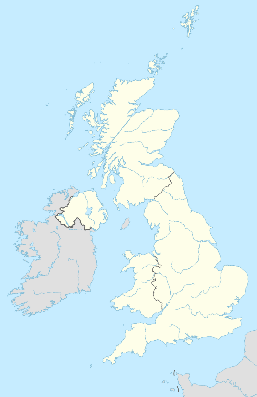
BA postcode area
The BA postcode area, also known as the Bath postcode area,[2] is a group of 19 postcode districts in South West England, within 16 post towns and around 15,136 live postcodes. These cover east Somerset (including Bath, Yeovil, Bruton, Castle Cary, Frome, Glastonbury, Radstock, Shepton Mallet, Street, Templecombe, Wells and Wincanton) and west Wiltshire (including Bradford on Avon, Trowbridge, Warminster and Westbury), plus a very small part of north-west Dorset.
| Bath postcode area | |
|---|---|
 BA | |
| Postcode area | BA |
| Postcode area name | Bath |
| Post towns | 16 |
| Postcode districts | 19 |
| Postcode sectors | 81 |
| Postcodes (live) | 15,136 |
| Postcodes (total) | 19,944 |
| Statistics as at May 2020[1] | |
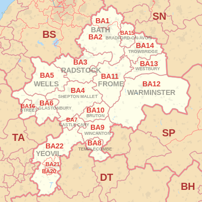
Coverage
The approximate coverage of the postcode districts:
| Postcode district | Post town | Coverage | Local authority area(s) |
|---|---|---|---|
| BA1 | BATH | Bath north of the Avon, Batheaston, Bathford | Bath and North East Somerset |
| BA2 | BATH | Bath south of the Avon, Farmborough, Timsbury, Peasedown St John, Wellow, Hinton Charterhouse, Norton St Philip, Freshford, Limpley Stoke | Bath and North East Somerset, Mendip, Wiltshire |
| BA3 | RADSTOCK | Radstock, Midsomer Norton, Holcombe, Coleford | Bath and North East Somerset, Mendip |
| BA4 | SHEPTON MALLET | Shepton Mallet | Mendip |
| BA5 | WELLS | Wells | Mendip |
| BA6 | GLASTONBURY | Glastonbury | Mendip |
| BA7 | CASTLE CARY | Castle Cary, Ansford, Alford, Lovington | South Somerset |
| BA8 | TEMPLECOMBE | Templecombe, Henstridge, Horsington | South Somerset |
| BA9 | BRUTON | non-geographic[3][4] | |
| BA9 | WINCANTON | Wincanton, Penselwood, Cucklington, Holton, Yarlington | South Somerset |
| BA10 | BRUTON | Bruton, Pitcombe, Redlynch, Brewham | South Somerset |
| BA11 | FROME | Frome | Mendip |
| BA12 | WARMINSTER | Warminster | Wiltshire |
| BA13 | WESTBURY | Westbury | Wiltshire |
| BA14 | TROWBRIDGE | Trowbridge | Wiltshire |
| BA15 | BRADFORD-ON-AVON | Bradford-on-Avon, Winsley, Westwood, Monkton Farleigh, South Wraxall | Wiltshire |
| BA16 | STREET | Street, Walton | Mendip |
| BA20 | YEOVIL | Yeovil (centre and south) | South Somerset |
| BA21 | YEOVIL | Yeovil (north), Mudford | South Somerset |
| BA22 | YEOVIL | Yeovil (west), East Coker, West Coker, Ilchester, Sparkford, Marston Magna, Halstock, Stoford, Clifton Maybank | South Somerset, Dorset |
Map
gollark: So separate the authorities certifying that you're not an idiot and the ones teaching you to not be an idiot!
gollark: It would be good for students to have the *option* to study it if they prefer it over other stuff, certainly.
gollark: I think they could research it on their own if they cared much.
gollark: It is useful but only if you actually care about it enough to remember any.
gollark: Reading/writing/arithmetic *can* probably just be taught at home by computers though.
References
- "ONS Postcode Directory Version Notes" (ZIP). National Statistics Postcode Products. Office for National Statistics. May 2020. Table 2. Retrieved 19 June 2020. Coordinates from mean of unit postcode points, "Code-Point Open". OS OpenData. Ordnance Survey. February 2012. Retrieved 21 April 2012.
- Royal Mail, Address Management Guide, (2004)
- "Non Geographic Codes" (PDF). Royal Mail Address Management Unit. July 2012. Archived from the original (PDF) on 16 September 2012. Retrieved 25 October 2012.
- "New sectors and localities to 19 October 2012" (PDF). Royal Mail Address Management Unit. 19 October 2012. Archived from the original (PDF) on 13 May 2013. Retrieved 25 October 2012.
External links
This article is issued from Wikipedia. The text is licensed under Creative Commons - Attribution - Sharealike. Additional terms may apply for the media files.