WF postcode area
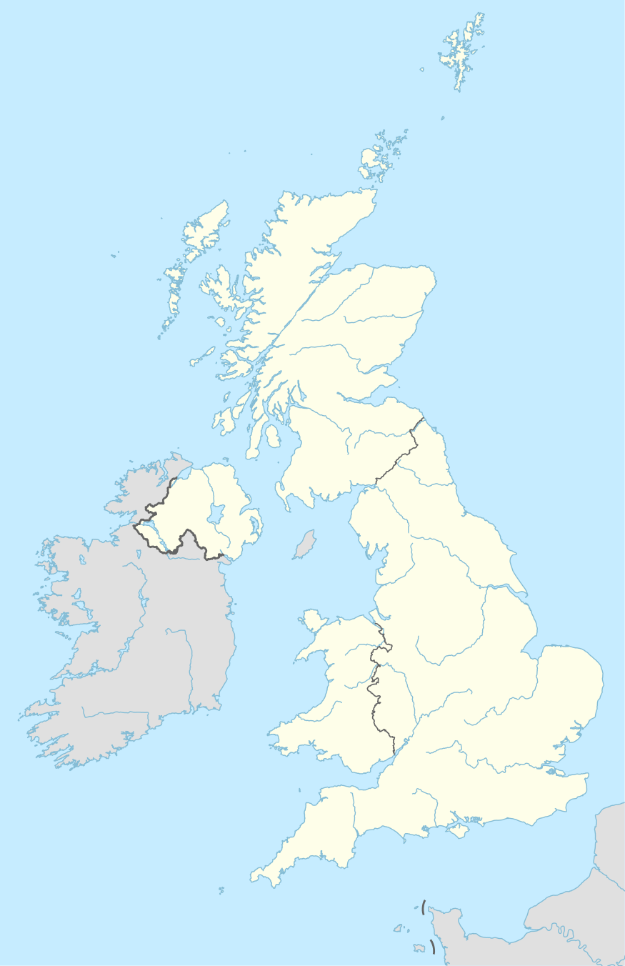
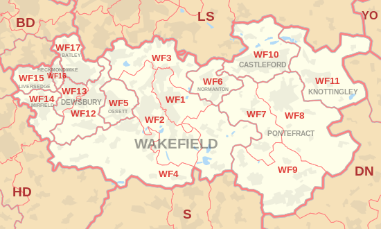
The WF postcode area, also known as the Wakefield postcode area,[2] is a group of 17 postcode districts in north-east England, which are subdivisions of eleven post towns. These cover much of southern and eastern West Yorkshire (including Wakefield, Pontefract, Dewsbury, Batley, Castleford, Heckmondwike, Knottingley, Liversedge, Mirfield, Normanton and Ossett), plus small parts of South and North Yorkshire.
| Wakefield postcode area | |
|---|---|
 WF | |
| Postcode area | WF |
| Postcode area name | Wakefield |
| Post towns | 11 |
| Postcode districts | 18 |
| Postcode sectors | 75 |
| Postcodes (live) | 14,415 |
| Postcodes (total) | 18,237 |
| Statistics as at May 2020[1] | |
Coverage
The approximate coverage of the postcode districts:
| Postcode district | Post town | Coverage | Local authority area(s) |
|---|---|---|---|
| WF1 | WAKEFIELD | Agbrigg, Belle Vue, Eastmoor, Kirkthorpe, Newton Hill, Outwood, Wakefield City Centre | Wakefield |
| WF2 | WAKEFIELD | Alverthorpe, Carr Gate, Flanshaw, Hall Green, Kirkhamgate, Kettlethorpe, Lupset, Portobello, Newmillerdam, Sandal, Thornes, Walton (Wakefield), Wrenthorpe, Woolgreaves, Peacock, Pledwick | Wakefield |
| WF3 | WAKEFIELD | Bottom Boat, Carlton, East Ardsley, Lofthouse, Lofthouse Gate, Robin Hood, Stanley, Thorpe, Tingley, West Ardsley | Leeds, Wakefield |
| WF4 | WAKEFIELD | Crigglestone, Crofton, Durkar, Flockton, Havercroft, Horbury, Netherton, New Crofton, Ryhill, West Bretton, Woolley | Wakefield, Kirklees |
| WF5 | OSSETT | Gawthorpe, Healey, Ossett (very small area around Wakefield Road falls in the Kirklees district) | Wakefield, Kirklees |
| WF6 | NORMANTON | Altofts, Normanton | Wakefield |
| WF7 | PONTEFRACT | Ackworth Moor Top, Ackton, Featherstone, Purston Jaglin, Streethouse | Wakefield |
| WF8 | PONTEFRACT | Darrington, Kirk Smeaton, Pontefract (Monkhill), Thorpe Audlin | Wakefield, Selby, Doncaster |
| WF9 | PONTEFRACT | Badsworth, Fitzwilliam, Hemsworth, Kinsley, South Elmsall, South Kirkby, Upton, Wentbridge | Wakefield, Doncaster |
| WF10 | CASTLEFORD | Airedale, Allerton Bywater, Castleford, Glasshoughton, Ledston, New Fryston | Wakefield, Leeds |
| WF11 | KNOTTINGLEY | Brotherton, Byram, Cridling Stubbs, Fairburn, Kellingley, Knottingley | Wakefield, Selby |
| WF12 | DEWSBURY | Chickenley, Dewsbury, Savile Town, Shaw Cross, Thornhill, Thornhill Lees | Kirklees, Wakefield |
| WF13 | DEWSBURY | Dewsbury Moor, Ravensthorpe | Kirklees |
| WF14 | MIRFIELD | Hopton, Mirfield | Kirklees |
| WF15 | LIVERSEDGE | Roberttown, Liversedge | Kirklees |
| WF16 | HECKMONDWIKE | Heckmondwike | Kirklees |
| WF17 | BATLEY | Birstall, Batley, Staincliffe | Kirklees |
| WF90 | WAKEFIELD | Redcats | non-geographic[3] |
Map
gollark: I mean, vast amounts in absolute terms, but not much compared to youtube.
gollark: There are a bunch of them, but they don't actually have very much content.
gollark: Not that you have access to that.
gollark: The osmarks video harvested from youtube™ archive, obviously.
gollark: And unpaid.
References
- "ONS Postcode Directory Version Notes" (ZIP). National Statistics Postcode Products. Office for National Statistics. May 2020. Table 2. Retrieved 19 June 2020. Coordinates from mean of unit postcode points, "Code-Point Open". OS OpenData. Ordnance Survey. February 2012. Retrieved 21 April 2012.
- Royal Mail, Address Management Guide, (2004)
- "Non Geographic Codes" (PDF). Royal Mail Address Management Unit. July 2012. Archived from the original (PDF) on 16 September 2012. Retrieved 20 December 2012.
External links
This article is issued from Wikipedia. The text is licensed under Creative Commons - Attribution - Sharealike. Additional terms may apply for the media files.
