TQ postcode area
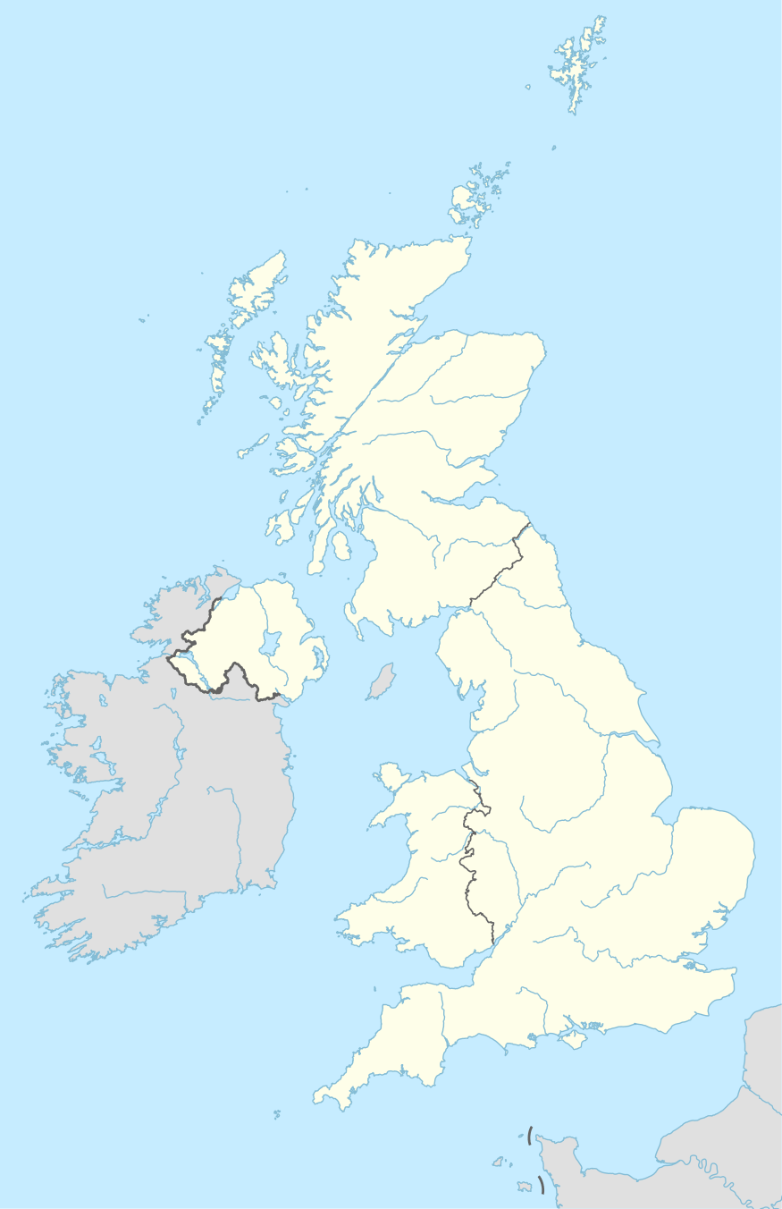
The TQ postcode area, also known as the Torquay postcode area,[2] is a group of fourteen postcode districts in South West England, within eleven post towns. These cover much of south Devon, including Torquay, Paignton, Newton Abbot, Brixham, Ashburton, Buckfastleigh, Dartmouth, Kingsbridge, Salcombe, South Brent, Teignmouth and Totnes.
| Torquay postcode area | |
|---|---|
 TQ | |
| Postcode area | TQ |
| Postcode area name | Torquay |
| Post towns | 11 |
| Postcode districts | 14 |
| Postcode sectors | 50 |
| Postcodes (live) | 9,974 |
| Postcodes (total) | 13,143 |
| Statistics as at May 2020[1] | |
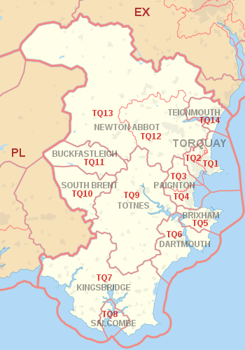
Coverage
The approximate coverage of the postcode districts:
| Postcode district | Post town | Coverage | Local authority area(s) |
|---|---|---|---|
| TQ1 | TORQUAY | Torquay (centre), St Marychurch | Torbay |
| TQ2 | TORQUAY | Torquay (west, north) | Torbay |
| TQ3 | PAIGNTON | Paignton (north, Preston area) | Torbay |
| TQ4 | PAIGNTON | Paignton (centre), Goodrington | Torbay |
| TQ5 | BRIXHAM | Brixham | Torbay |
| TQ6 | DARTMOUTH | Dartmouth | South Hams |
| TQ7 | KINGSBRIDGE | Kingsbridge | South Hams |
| TQ8 | SALCOMBE | Salcombe | South Hams |
| TQ9 | TOTNES | Totnes, Dartington | South Hams |
| TQ9 | SOUTH BRENT | non-geographic[3][4] | |
| TQ10 | SOUTH BRENT | South Brent | South Hams |
| TQ11 | BUCKFASTLEIGH | Buckfastleigh | Teignbridge |
| TQ12 | NEWTON ABBOT | Newton Abbot, Kingsteignton | Teignbridge |
| TQ13 | NEWTON ABBOT | Ashburton, Bovey Tracey, Chudleigh, Moretonhampstead, Widecombe in the Moor | Teignbridge |
| TQ14 | TEIGNMOUTH | Teignmouth | Teignbridge |
Map
gollark: https://github.com/jbangert/trapcc
gollark: Oh yes, I heard of that.
gollark: It lets you parameterize modules over types, or something confusing like that.
gollark: ~~copy rust's in its entirety~~
gollark: > if you want a scope in which there are functions in C, just create a file and pepend static to your functionæ.
References
- "ONS Postcode Directory Version Notes" (ZIP). National Statistics Postcode Products. Office for National Statistics. May 2020. Table 2. Retrieved 19 June 2020. Coordinates from mean of unit postcode points, "Code-Point Open". OS OpenData. Ordnance Survey. February 2012. Retrieved 21 April 2012.
- Royal Mail, Address Management Guide, (2004)
- "Non Geographic Codes" (PDF). Royal Mail Address Management Unit. July 2012. Archived from the original (PDF) on 16 September 2012. Retrieved 25 October 2012.
- "New sectors and localities to 19 October 2012" (PDF). Royal Mail Address Management Unit. 19 October 2012. Archived from the original (PDF) on 13 May 2013. Retrieved 25 October 2012.
External links
This article is issued from Wikipedia. The text is licensed under Creative Commons - Attribution - Sharealike. Additional terms may apply for the media files.