Peasedown St John
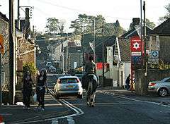
Peasedown St John (commonly referred to as Peasedown) is a village and civil parish in Somerset, England. Standing on a hilltop roughly 5 miles (8 km) south-southwest of the city of Bath, Peasedown used to be a coal mining village. When the last of the mines was shut in the 1970s it became a dormitory village for Bath and, to a lesser extent, Bristol. Its size has been increased by substantial housing developments in the 1960s, 1970s and late 1990s, making it one of the largest villages in Somerset.
| Peasedown St John | |
|---|---|
 The main street | |
 Peasedown St John Location within Somerset | |
| Population | 6,446 (2011)[1] |
| OS grid reference | ST705574 |
| Unitary authority | |
| Ceremonial county | |
| Region | |
| Country | England |
| Sovereign state | United Kingdom |
| Post town | Bath |
| Postcode district | BA2 |
| Dialling code | 01761 |
| Police | Avon and Somerset |
| Fire | Avon |
| Ambulance | South Western |
| UK Parliament | |
History
Archaeological and documentary evidence shows that the site has been occupied from at least the early Iron Age.[2] There is good evidence of Roman and Saxon villages in the area, the Saxon settlements resulting in several entries in the Domesday Book of 1086.[3] The medieval settlement of Eckweek was excavated in 1989,[4] and now lies under the Peasedown Bypass and Underknoll Road.
The present village of Peasedown St John is relatively modern. 'A place known by the name of The Red Post' was how the scattering of buildings was referred to in 1768,[5] taking its name from the local Public House. The hamlet of Carlingcott on the north-west edge of Peasedown is known to have existed before 1800 but the main modern development in the area began in the 19th century when the Somerset Coalfield was greatly expanded as the Industrial Revolution increased demand for coal across England. By 1841 there was still no discernible village,[6] except a few cottages around the Red Post and a small number of buildings along what would become the Bath Road. The sinking of the Braysdown colliery in 1845 meant that accommodation had to be built for the enlarged workforce to work the new pit and expansion of the village was now inevitable.[7]
By the second half of the 20th century there were at least six collieries within 3 km (1.9 mi) of Peasedown, including Braysdown, Camerton, Dunkerton, Writhlington and Shoscombe.
The rapid growth of non-conformist religion across the North-Somerset Coalfield in the later 1800s and early 1900s was evident in Peasedown St John. There was a Primitive Methodist Chapel on the Bath Road (now Peasedown Methodist Church), Wesleyan Chapels in Braysdown Lane, New Buildings and Carlingcott, a United Methodist Chapel in Carlingcott (now Carlingcott Methodist Chapel), a Baptist Chapel on Eckweek Road (now Zebedees Nursery School) and a Christadelphian Hall which still stands on Huddox Hill.[8]
With the closure of the coal mines in the period up to the 1970s, and the growing popularity of out-of-town living, Peasedown rapidly became a commuter village for the cities of Bath and Bristol. This increased with two further phases of construction, the first in the 1950s and 1960s and the second in the late 1990s and early 2000s. Both involved the construction of what were intended as affordable family housing, the first phase being mainly in the southeast of the village and consisting mostly of terraced or semi-detached properties.
Governance
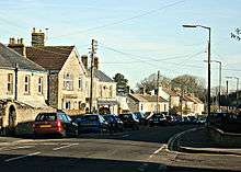
Although it was between 1850 and 1890 that Peasedown grew into being a distinct settlement, it was not until 1955 that it became a civil parish,[2] officially remaining divided for administrative purposes between Camerton, Wellow and Dunkerton until that point.
The parish council, which has 17 members,[9] has responsibility for local issues, including setting an annual precept (local rate) to cover the council's operating costs and producing annual accounts for public scrutiny. The parish council evaluates local planning applications and works with the local police, district council officers, and neighbourhood watch groups on matters of crime, security, and traffic. The parish council's role also includes initiating projects for the maintenance and repair of parish facilities, such as the village hall or community centre, playing fields and playgrounds, as well as consulting with the district council on the maintenance and improvement of highways, drainage, footpaths, public transport and street cleaning. Conservation matters (including trees and listed buildings) and environmental issues are also of interest to the council.
The parish falls within the unitary authority of Bath and North East Somerset, and within the ceremonial county of Somerset but it is administered independently of the non-metropolitan county. Between 1 April 1974 and 1 April 1996 it was in the Wansdyke district of the county of Avon.[10] Before 1974 that the parish was part of the Bathavon Rural District.[11]
The village falls within 'Peasedown' electoral ward with the same area and population as the parish.
The parish is represented in the House of Commons of the Parliament of the United Kingdom as part of North East Somerset. It is also part of the South West England constituency of the European Parliament.
Geography

Peasedown lies on one of the many hills outside Bath, roughly 7 km (4.3 mi) south-southwest of Bath and 20 km (12 mi) southeast of Bristol. Much the village lies on the relatively flat section on the top of the hill, but the northwestern side of the village is on the slope of the hill.
The hamlets of Wellow and Shoscombe are sometimes regarded as part of Peasedown, but this is not correct, although Braysdown, New Buildings and Carlingcott are both still in the Parish of Peasedown St John.
Climate
Along with the rest of South West England, Peasedown St John has a temperate climate which is generally wetter and milder than the rest of the country.[12] The annual mean temperature is approximately 10 °C (50.0 °F). Seasonal temperature variation is less extreme than most of the United Kingdom because of the adjacent sea temperatures. The summer months of July and August are the warmest with mean daily maxima of approximately 21 °C (69.8 °F). In winter mean minimum temperatures of 1 °C (33.8 °F) or 2 °C (35.6 °F) are common.[12] In the summer the Azores high pressure affects the south-west of England, however convective cloud sometimes forms inland, reducing the number of hours of sunshine. Annual sunshine rates are slightly less than the regional average of 1,600 hours.[12] In December 1998 there were 20 days without sun recorded at Yeovilton. Most of the rainfall in the south-west is caused by Atlantic depressions or by convection. Most of the rainfall in autumn and winter is caused by the Atlantic depressions, which is when they are most active. In summer, a large proportion of the rainfall is caused by sun heating the ground leading to convection and to showers and thunderstorms. Average rainfall is around 700 mm (28 in). About 8–15 days of snowfall is typical. November to March have the highest mean wind speeds, and June to August have the lightest winds. The predominant wind direction is from the south-west.[12]
Demography
At the 2001 census the population of Peasedown was around 5,000, but owing to the recent housing developments, estimates for 2005 put the population of the village at nearer 6,500.[1] The largest identifiable population group in Peasedown is married couples aged 20 to 44 who comprise almost half the total population of the village.[13]
Facilities and amenities
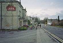
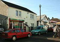
Peasedown St John has a wide range of public facilities and amenities. These include a doctors' surgery, a dental practice, a veterinary practice, three public houses (The Prince of Wales, The Waggon & Horses and The Red Post which was built in 1851[14]), a youth centre, cricket and football clubs, two convenience stores, pharmacy, baker, post office with newsagent,[15], petrol station/car parts shop, two hairdressers, three takeaways, hardware shop, and a charity shop. Circle Bath Hospital, just off the bypass and to the south, is designed by Foster and Partners. There are also many other business establishments and car showrooms on this business park. There is a direct hospital bus service to/from Bath.[16]
There are three children's play areas at Beacon Field, Eckweek Lane and on 'the Rec' (Peasedown Recreation Field), with the play area on 'the Rec' including a skate park.[17] There is a further public open space at Ecewiche Green. Beacon Hall is the home of the Peasedown St John Community Association.[18]
Organisations and clubs
There are various sports clubs in Peasedown St John. Peasedown Athletic Football Club began life in the late 1800s as Peasedown Miners Welfare. The club continues to field a senior team in the Somerset County League and a Reserve side in the Midsomerset Football League.[19] Peasedown Albion Football Club runs junior sides for 150 children and teenagers.[20] Peasedown St John Cricket Club was founded over 100 years ago. Today it runs several adult teams and three youth teams.[21] Adjacent to the ground is the Club House which is also used to hold a variety of social functions. Camerton and Peasedown Crouquet Club launched in 2011 constructing four level lawns and formerly opening in spring 2012.[22]
Peasedown St John Scout Group runs Beavers, Cubs and Scouts for young people aged 6–14[23] while Explorer Scouts exists for older teenagers.
Transport
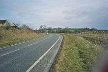
The A367 (which follows the route of the Roman Fosse Way) between Lincoln and Exeter used to run through Peasedown, but it was bypassed in the mid-1990s.[24] First West of England provides Peasedown St. John with bus services to and from Bath, Radstock, Midsomer Norton, Paulton, Shepton Mallet and Wells. All of these services are direct. Bus connections to Bristol and in other directions are frequent via Bath.
Education
There is a large Primary School in Peasedown St John, built in 1913 and extended significantly in recent years.[25] In a 2007 inspection report it was described as "A good school with many outstanding features".[26] This judgement was reiterated by Ofstead in 2011.[27]
The nearest Secondary School is Writhlington School in Writhlington, Radstock. Several School Coaches run daily between Peasedown St John and Writhlington School. The completion of the new School Campus in 2010[28] and the School's 2011 Report[29] have increased Writhlington School's local profile. Other local Secondary Schools are also provided in Midsomer Norton and Bath. Further and higher education locally is provided by the University of Bath, Bath Spa University, the City of Bath College, and Norton Radstock College. Special needs education is provided by Three Ways School.
Religious communities
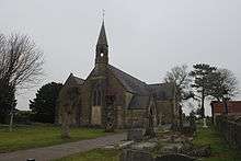
Peasedown St John currently has four Christian churches: Church of England, Methodist, Catholic and Christadelphian, and there is also a Methodist church in Carlingcott.
The Parish Church of St John the Baptist was created on 6 August 1874[30] by Order in Council. Instrumental in its foundation were the Misses Jarrett of Camerton Court, owners of the Camerton Collieries which employed many Peasedown men. As well as providing the land and much of the capital for the construction of the church of St John the Baptist and the adjacent vicarage, they were also responsible for building the first School buildings which stood on Jarrett land in what became Church Road. The current church building (on Church Road) dates from 1893, and was designed by George Frederick Bodley and Thomas Garner, replacing an earlier iron structure.[31] The Church is home to a growing congregation, and with an emphasis on Bible teaching and a belief in the work of the Holy Spirit. Today St John's Church forms part of 'the St J's' Benefice, which also includes St Julian's Church in Wellow and St James the Less Church in Foxcote with St Julian's Chapel in Shoscombe.
Peasedown St John Methodist Church was also founded in 1874.[32] The church congregation is very active in the community, hosting youth work, lunches for the elderly, drug intervention schemes, and children's clubs.
Peasedown Christadelphian Hall is located on Huddox Hill.
Cultural references
Peasedown St John was one of several local villages where in the 1930s budding children's author Roald Dahl used to sell kerosene. As he described in his autobiographical work Boy: Tales of Childhood (published 1984):
My kerosene motor-tanker had a tap at the back and when I rolled into Shepton Mallet or Midsomer Norton or Peasedown St John or Huish Champflower, the old girls and the young maidens would hear the roar of my motor and would come out of their cottages with jugs and buckets to buy a gallon of kerosene for their lamps and their heaters. It is fun for a young man to do that sort of thing. Nobody gets a nervous breakdown or a heart attack from selling kerosene to gentle country folk from the back of a tanker in Somerset on a fine summer's day.
Notable people
- Peter Alexander, (born 1952), actor who played Phil Pearce in Emmerdale and appeared in EastEnders, Hollyoaks, Brookside and Coronation Street, spent the first seven years of his life in Peasedown.[7]
- Sir Frank Beauchamp (1866-1950), owner of coalmines in the Somerset coalfield, lived in Woodborough House just south of the village. [33]
- Alec Stock (30 March 1917 – 16 April 2001) English footballer and manager. Played for Tottenham Hotspur, Charlton Athletic, Queens Park Rangers (QPR) and Yeovil Town. Managed Leyton Orient, A.S. Roma, QPR, Luton Town, Fulham and A.F.C. Bournemouth. Also assistant manager of Arsenal and a director of QPR.[34]
References
- "Peasedown St John Parish". Neighbourhood Statistics. Office for National Statistics. Retrieved 31 December 2013.
- "Parish Design Statement". Peasedown St John Parish Council. Retrieved 18 February 2012.
- "History of Peasedown St John". Peasedown St John Parish Council. Retrieved 18 February 2012.
- "Eckweek deserted Medieval Settlement Avon Geophysical Survey, 1989". English Heritage. Archived from the original on 25 September 2006. Retrieved 29 August 2010.
- The Somerset Roads Act 1768
- The Wellow Tithe Map, 1841
- "The History of Peasedown St John". Peasedown St John Parish Council. Retrieved 29 December 2011.
- 'Peasedown St John One Hundred Years Ago' by Dick Graham, The Journal of the Radstock, Midsomer Norton and District Museum Society Issue No. 72 Winter 2011
- "Your Councillors". Peasedown St John Parish Council. Retrieved 29 August 2010.
- "The Avon (Structural Change) Order 1995". HMSO. Archived from the original on 30 January 2008. Retrieved 9 December 2007.
- "Bathavon RD". A vision of Britain Through Time. University of Portsmouth. Retrieved 4 January 2014.
- "South West England: climate". Met Office. Archived from the original on 5 June 2011. Retrieved 14 March 2010.
- "Parish Profile — People". Neighbourhood Statistics. Office for National Statistics. Retrieved 24 March 2010.
- "Red Post Inn". historicengland.org.uk. English Heritage. Retrieved 29 August 2010.
- "Peasedown Post Office". Peasedown Post Office. Archived from the original on 11 April 2003. Retrieved 29 August 2010.
- "Circle Bath". NHS Choices. Retrieved 29 August 2010.
- "Peasedown Recreation Ground". Bath and North East Somerset. Archived from the original on 15 January 2011. Retrieved 29 August 2010.
- "History of the Hall". Peasedown St John Community Association. Retrieved 29 August 2010.
- "Peasedown Athletic FC". Retrieved 13 May 2012.
- "Peasedown Albion FC". Retrieved 13 May 2012.
- "Peasedown St John Cricket Club". Retrieved 13 May 2012.
- "Camerton and Peasedown Croquet Club". Retrieved 13 May 2012.
- "Peasedown St John Scout Group". Retrieved 13 May 2012.
- "Peasedown St. John". Radstock 4 you. Retrieved 30 November 2010.
- "Peasedown St. John Primary School". Peasedown St. John Primary School. Retrieved 29 August 2010.
- "Peasedown St John Primary School". Ofsted. Retrieved 29 December 2011.
- Letter dated 26 April 2011 sent to parents of pupils by Christine Gilbert of Ofstead "Letter from Ofstead" (PDF). Ofsted. Retrieved 29 December 2011.
- "Writhlington School". Retrieved 29 December 2011.
- "Writhlington School Ofstead Report". Retrieved 29 December 2011.
- see London Gazette published 11 August 1974
- "History". St John's Parish. Archived from the original on 15 July 2011. Retrieved 29 August 2010.
- "From 110th Anniversary sheet (1984)". Peasedown Methodist Church. Retrieved 29 August 2010.
- http://www.dmm.org.uk/company/n1019.htm
- "Alec Stock". Obituaries. London: The Guardian. 18 April 2001. Retrieved 29 December 2011.