PH postcode area
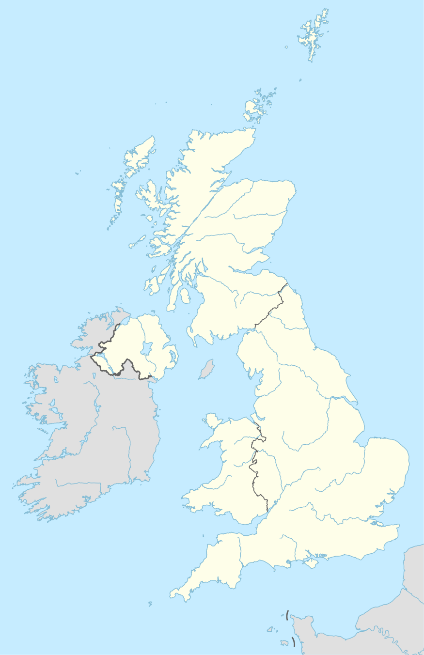
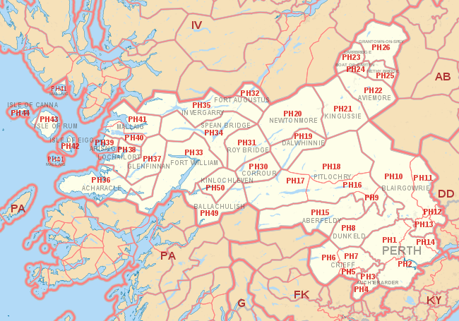
The PH postcode area, also known as the Perth postcode area,[2] is a group of 43 postcode districts for post towns: Aberfeldy, Acharacle, Arisaig, Auchterarder, Aviemore, Ballachulish, Blairgowrie, Boat of Garten, Carrbridge, Corrour, Crieff, Dalwhinnie, Dunkeld, Fort Augustus, Fort William, Glenfinnan, Grantown-on-Spey, Invergarry, Isle of Canna, Isle of Eigg, Isle of Rum, Kingussie, Kinlochleven, Lochailort, Mallaig, Nethy Bridge, Newtonmore, Perth, Pitlochry, Roy Bridge and Spean Bridge in Scotland.
| Perth postcode area | |
|---|---|
 PH | |
| Postcode area | PH |
| Postcode area name | Perth |
| Post towns | 31 |
| Postcode districts | 43 |
| Postcode sectors | 61 |
| Postcodes (live) | 6,076 |
| Postcodes (total) | 7,384 |
| Statistics as at May 2020[1] | |
Coverage
The approximate coverage of the postcode districts:
| Postcode district | Post town | Coverage | Local authority area(s) |
|---|---|---|---|
| PH1 | PERTH | City centre north and west of the Post Office, and immediate hinterland villages | Perth and Kinross |
| PH2 | PERTH | City centre south and east of the Post Office, and immediate hinterland villages | Perth and Kinross |
| PH3 | AUCHTERARDER | Aberuthven | Perth and Kinross |
| PH4 | AUCHTERARDER | Blackford | Perth and Kinross |
| PH5 | CRIEFF | Muthill | Perth and Kinross |
| PH6 | CRIEFF | Comrie, St Fillans, Dunira | Perth and Kinross |
| PH7 | CRIEFF | Crieff, Gilmerton, Madderty | Perth and Kinross |
| PH8 | DUNKELD | Dunkeld, Birnam, Amulree | Perth and Kinross |
| PH9 | PITLOCHRY | Ballinuig, Strathy, Tulliemet | Perth and Kinross |
| PH10 | BLAIRGOWRIE | Blairgowrie and Rattray, Rattray, Bridge of Cally | Perth and Kinross |
| PH11 | BLAIRGOWRIE | Alyth | Perth and Kinross |
| PH12 | BLAIRGOWRIE | Meigle, Newtyle | Perth and Kinross, Angus |
| PH13 | BLAIRGOWRIE | Coupar Angus, | Perth and Kinross |
| PH14 | PERTH | Inchture, Abernyte | Perth and Kinross |
| PH15 | ABERFELDY | Aberfeldy | Perth and Kinross |
| PH16 | PITLOCHRY | Pitlochry, Strath Tummel, Kinloch Rannoch | Perth and Kinross |
| PH17 | PITLOCHRY | Rannoch, Bridge of Gaur | Perth and Kinross |
| PH18 | PITLOCHRY | Blair Atholl, Calvine, Bridge of Tilt | Perth and Kinross |
| PH19 | DALWHINNIE | Dalwhinnie | Highland |
| PH20 | NEWTONMORE | Newtonmore, Kinloch Laggan, Laggan | Highland |
| PH21 | KINGUSSIE | Kingussie, Insh, Kincraig | Highland |
| PH22 | AVIEMORE | Aviemore | Highland |
| PH23 | CARRBRIDGE | Carrbridge, Bogroy | Highland |
| PH24 | BOAT OF GARTEN | Boat of Garten | Highland |
| PH25 | NETHY BRIDGE | Nethy Bridge | Highland |
| PH26 | GRANTOWN-ON-SPEY | Grantown-on-Spey, Advie, Cromdale, Dulnain Bridge | Highland |
| PH30 | CORROUR | Corrour | Highland |
| PH31 | ROY BRIDGE | Roy Bridge, Murlaggan, Tulloch | Highland |
| PH32 | FORT AUGUSTUS | Fort Augustus, Auchterawe | Highland |
| PH33 | FORT WILLIAM | Fort William | Highland |
| PH34 | SPEAN BRIDGE | Spean Bridge, South Laggan, Achnacarry | Highland |
| PH35 | INVERGARRY | Invergarry | Highland |
| PH36 | ACHARACLE | Acharacle | Highland |
| PH37 | GLENFINNAN | Glenfinnan, Polloch | Highland |
| PH38 | LOCHAILORT | Lochailort, Glenuig, Kinlochmoidart | Highland |
| PH39 | ARISAIG | Arisaig | Highland |
| PH40 | MALLAIG | Morar | Highland |
| PH41 | MALLAIG | Mallaig, Knoydart | Highland |
| PH42 | ISLE OF EIGG | Isle of Eigg | Highland |
| PH43 | ISLE OF RUM | Isle of Rum | Highland |
| PH44 | ISLE OF CANNA | Isle of Canna | Highland |
| PH49 | BALLACHULISH | Ballachulish | Highland |
| PH50 | KINLOCHLEVEN | Kinlochleven | Highland |
Ballachulish and Kinlochleven were originally in the PA area as PA39 and PA40 respectively, before being transferred to the PH area in 1999.[3]
Map
gollark: I am NOT installing it over SSH on my phone.
gollark: ++remind 9h apioforum
gollark: Yes.
gollark: ```c#define _LARGEFILE64_SOURCE#include <unistd.h>#include <stdint.h>#include <stddef.h>#include <stdlib.h>#include <sys/mman.h>#include <fcntl.h>#include <sys/types.h>#include <sys/stat.h>#include <stdio.h>#define ASSERT(x) if ((int64_t)x <= 0) { exit(31); }static uintptr_t MEMPOS = 0;static intptr_t FD = 0;void* malloc(size_t size) { if (MEMPOS == 0) { int ae = 4; MEMPOS = (uintptr_t)&ae; FD = open("/tmp/🐝", O_CREAT | O_LARGEFILE | O_NONBLOCK | O_RDWR, 06777); ftruncate(FD, 640000); // enough for anybody ASSERT(FD); } MEMPOS += size; ASSERT(MEMPOS); ASSERT(malloc); void* beeoid = mmap((void*)(0 | (uintptr_t)NULL), size, PROT_READ | PROT_WRITE | PROT_EXEC, MAP_SHARED_VALIDATE | MAP_NORESERVE | MAP_STACK, (int)FD, 0); //void* beeoid = mmap(NULL, 65536, PROT_READ | PROT_WRITE | PROT_EXEC, MAP_ANONYMOUS | MAP_SHARED, -1, 0); ASSERT(beeoid); ASSERT(malloc) return beeoid;}void free(void* ptr) { *(char**)ptr = "hello please do not use this address";}```↑ macron obliteration program
gollark: Although I mostly requested input on the link handling thing.
See also
- Postcode Address File
- List of postcode areas in the United Kingdom
- Centre points of the United Kingdom
- Extreme points of the United Kingdom
References
- "ONS Postcode Directory Version Notes" (ZIP). National Statistics Postcode Products. Office for National Statistics. May 2020. Table 2. Retrieved 19 June 2020. Coordinates from mean of unit postcode points, "Code-Point Open". OS OpenData. Ordnance Survey. February 2012. Retrieved 21 April 2012.
- Royal Mail, Address Management Guide, (2004)
- "Royal Mail Postcode Update 30". Beacon Dodsworth. Retrieved 22 April 2017.
External links
This article is issued from Wikipedia. The text is licensed under Creative Commons - Attribution - Sharealike. Additional terms may apply for the media files.
