OL postcode area
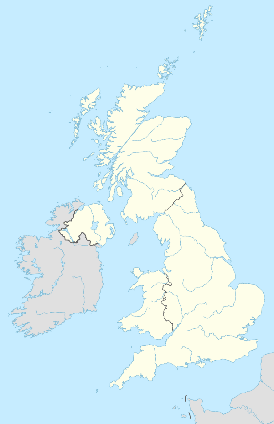
The OL postcode area, also known as the Oldham postcode area,[2] is a group of sixteen postcode districts in north-west England, within seven post towns. These cover eastern Greater Manchester (including Oldham, Rochdale, Ashton-under-Lyne, Heywood and Littleborough), plus small parts of east Lancashire (including Bacup) and western West Yorkshire (including Todmorden).
| Oldham postcode area | |
|---|---|
 OL | |
| Postcode area | OL |
| Postcode area name | Oldham |
| Post towns | 7 |
| Postcode districts | 17 |
| Postcode sectors | 70 |
| Postcodes (live) | 13,044 |
| Postcodes (total) | 17,647 |
| Statistics as at May 2020[1] | |
Coverage
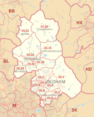
The approximate coverage of the postcode districts are:
| Postcode district | Post town | Coverage | Local authority area(s) |
|---|---|---|---|
| OL1 | OLDHAM | Chadderton, Higginshaw, Oldham | Oldham |
| OL2 | OLDHAM | Heyside, Royton, Shaw | Oldham |
| OL3 | OLDHAM | Delph, Denshaw, Diggle, Dobcross, Greenfield, Uppermill | Oldham |
| OL4 | OLDHAM | Austerlands, Grasscroft, Grotton, Lees, Lydgate, Oldham, Scouthead, Springhead, Waterhead | Oldham |
| OL5 | ASHTON-UNDER-LYNE | Mossley, Mossley Cross | Tameside |
| OL6 | ASHTON-UNDER-LYNE | Ashton-under-Lyne (centre and east) | Tameside |
| OL7 | ASHTON-UNDER-LYNE | Ashton-under-Lyne (west) | Tameside |
| OL8 | OLDHAM | Bardsley, Oldham | Oldham |
| OL9 | OLDHAM | Chadderton, Oldham, Westwood, Freehold | Oldham |
| OL10 | HEYWOOD | Heywood | Rochdale |
| OL11 | ROCHDALE | Rochdale (south), Ashworth, Balderstone, Castleton, Norden | Rochdale |
| OL12 | ROCHDALE | Rochdale (north), Buckley, Facit, Great Howarth, Healy, Hurstead, Shawforth, Wardle, Whitworth | Rochdale, Rossendale |
| OL13 | BACUP | Bacup, Britannia, Stacksteads | Rossendale |
| OL14 | TODMORDEN | Cornholme, Todmorden, Eastwood, Walsden | Calderdale |
| OL15 | LITTLEBOROUGH | Littleborough, Shore, Smithybridge, Summit | Rochdale |
| OL16 | LITTLEBOROUGH | non-geographic[3][4] | |
| OL16 | ROCHDALE | Rochdale (east), Burnedge, Firgrove, Hurstead, Milnrow, Smallbridge, Thornham | Rochdale |
| OL95 | OLDHAM | British Gas | non-geographic[3] |
Map
gollark: ```Brute Dragons are among the larger Comrade breeds. They prefer to live in solitude or small groups, nesting in high, mountainous regions. The only time they openly seek the company of others is during the mating season, when males will fight for the attention of females. The thunderous crash of Brute Dragons butting horns against each other in competition for mates can be heard nearly a mile away.Dragons are highly-intelligent reptilian creatures that—from a human perspective, at least—appear to live forever. Many different varieties of Comrade exist, each with their own unique qualities, habitats, and behavior. Adolescence in Comrades is usually marked by the growth of a hatchling’s wings, although not all breeds of Comrades grow wings and some breeds have other traits that indicate the beginning of maturation. In Galsreim, Comrades and humans coexist peacefully.```
gollark: v0, which just replaces dragon with Comrade, is a great success.
gollark: Okay, the replacing thing is kind of hard.
gollark: I'll just make a userscript for it now.
gollark: Let me just do that.
References
- "ONS Postcode Directory Version Notes" (ZIP). National Statistics Postcode Products. Office for National Statistics. May 2020. Table 2. Retrieved 19 June 2020. Coordinates from mean of unit postcode points, "Code-Point Open". OS OpenData. Ordnance Survey. February 2012. Retrieved 21 April 2012.
- Royal Mail, Address Management Guide, (2004)
- "Non Geographic Codes" (PDF). Royal Mail Address Management Unit. July 2012. Archived from the original (PDF) on 16 September 2012. Retrieved 20 December 2012.
- "New sectors and localities to 14 December 2012" (PDF). Royal Mail Address Management Unit. 20 December 2012. Archived from the original (PDF) on 2 February 2015. Retrieved 20 December 2012.
External links
This article is issued from Wikipedia. The text is licensed under Creative Commons - Attribution - Sharealike. Additional terms may apply for the media files.