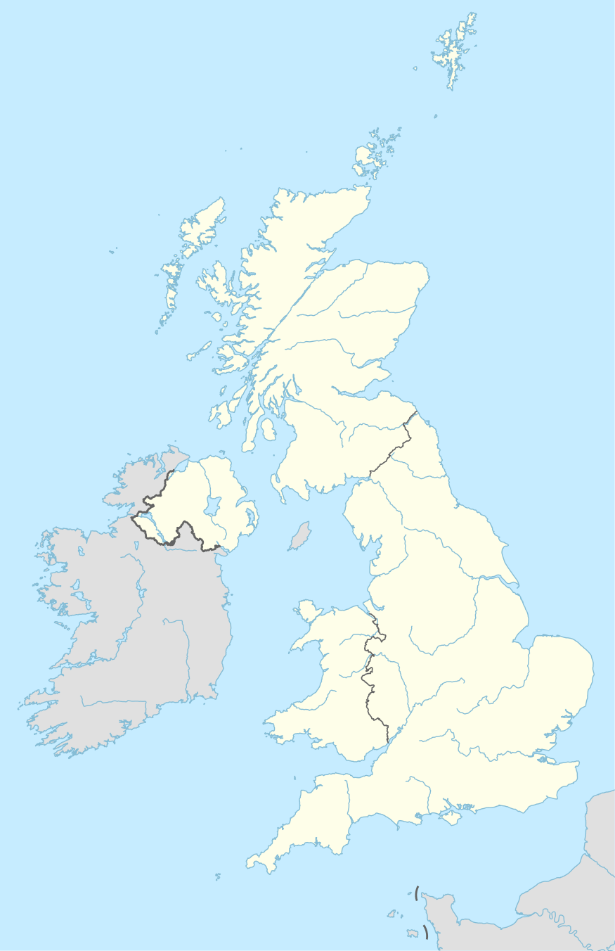
GU postcode area
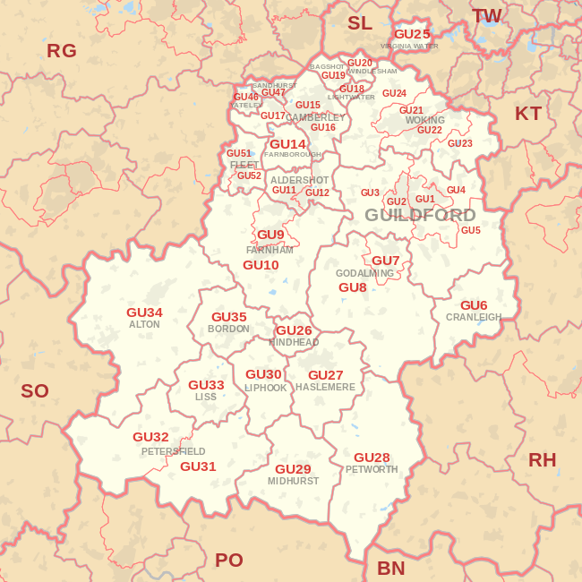
The GU postcode area, also known as the Guildford postcode area,[2] is a group of 38 postcode districts in South East England, within 24 post towns. These cover west Surrey (including Guildford, Woking, Farnham, Haslemere, Camberley, Lightwater, Godalming, Bagshot, Hindhead, Virginia Water and Cranleigh), east Hampshire (including Aldershot, Farnborough, Fleet, Liphook, Liss, Petersfield, Alton, Bordon and Yateley), northwestern West Sussex (including Petworth and Midhurst), and a small part of south-east Berkshire (including Sandhurst).
| Guildford postcode area | |
|---|---|
 GU | |
| Postcode area | GU |
| Postcode area name | Guildford |
| Post towns | 24 |
| Postcode districts | 40 |
| Postcode sectors | 144 |
| Postcodes (live) | 22,119 |
| Postcodes (total) | 35,570 |
| Statistics as at May 2020[1] | |
Mail for this area is sorted at the Jubilee Mail Centre in Hounslow.
Coverage
The approximate coverage of the postcode districts:
| Postcode district | Post town | Coverage | Local authority area(s) |
|---|---|---|---|
| GU1 | GUILDFORD | Guildford Town Centre, Slyfield, Merrow, Burpham | Guildford |
| GU2 | GUILDFORD | Guildford Park, Onslow Village, Park Barn, University of Surrey | Guildford |
| GU3 | GUILDFORD | Normandy, Puttenham, Worplesdon, Christmas Pie, Flexford | Guildford |
| GU4 | GUILDFORD | Burpham, Chilworth, Jacobs Well, Shalford | Guildford |
| GU5 | GUILDFORD | Albury, Bramley, Shere | Guildford, Waverley |
| GU6 | CRANLEIGH | Cranleigh, Ewhurst, Alfold | Waverley |
| GU7 | GODALMING | Farncombe, Godalming | Waverley |
| GU8 | GODALMING | Chiddingfold, Dunsfold, Elstead, Hascombe, Milford, Thursley, Witley | Waverley |
| GU9 | FARNHAM | Farnham, Badshot Lea, Hale, Heath End | Waverley |
| GU10 | FARNHAM | Bentley, Frensham, Churt, Crondall, Tongham, Ewshot, Seale, Tilford, Wrecclesham | Waverley, East Hampshire, Guildford, Hart |
| GU11 | ALDERSHOT | Aldershot | Rushmoor |
| GU12 | ALDERSHOT | Aldershot, Ash, Ash Green, Ash Vale | Rushmoor, Guildford |
| GU14 | FARNBOROUGH | Farnborough, Cove, North Camp, Southwood | Rushmoor |
| GU15 | CAMBERLEY | Camberley, Old Dean, RMAS | Surrey Heath, Bracknell Forest |
| GU16 | CAMBERLEY | Frimley, Frimley Green, Deepcut, Mytchett | Surrey Heath |
| GU17 | CAMBERLEY | Blackwater, Hawley, Minley, Darby Green, Frogmore, Blackbushe | Hart |
| GU18 | LIGHTWATER | Lightwater | Surrey Heath |
| GU19 | BAGSHOT | Bagshot | Surrey Heath |
| GU20 | WINDLESHAM | Windlesham | Surrey Heath |
| GU21 | WOKING | Woking, Knaphill, St. John's, Horsell, Goldsworth Park | Woking |
| GU22 | WOKING | Woking, Pyrford, Hook Heath, Mayford, Old Woking | Woking |
| GU23 | WOKING | Send, Ripley, Ockham, Wisley | Guildford |
| GU24 | WOKING | Bisley, Pirbright, Chobham, Knaphill, Brookwood, West End | Woking, Surrey Heath, Guildford |
| GU25 | VIRGINIA WATER | Virginia Water, Wentworth | Runnymede |
| GU26 | HINDHEAD | Hindhead, Bramshott Chase, Grayshott | Waverley, East Hampshire |
| GU27 | HINDHEAD | non-geographic[3] | |
| GU27 | HASLEMERE | Haslemere, Fernhurst, Shottermill, Grayswood | Waverley, Chichester |
| GU28 | PETWORTH | Petworth, Graffham, Northchapel, Byworth, Lodsworth | Chichester |
| GU29 | MIDHURST | Midhurst, Cocking, Easebourne | Chichester |
| GU30 | LIPHOOK | Liphook, Bramshott, Conford, Linch, Milland, Passfield | East Hampshire, Chichester |
| GU31 | PETERSFIELD | Petersfield, Buriton, East Harting, South Harting, Elsted, Rogate | East Hampshire, Chichester |
| GU32 | PETERSFIELD | East Meon, West Meon, Sheet, Steep | East Hampshire, Winchester |
| GU33 | LISS | Liss, Greatham, Selborne, Rake | East Hampshire, Chichester |
| GU34 | ALTON | Alton, Beech, Bentworth, Medstead, Four Marks, Golden Pot, Lasham | East Hampshire |
| GU35 | BORDON | Bordon, Headley, Headley Down, Lindford, Oakhanger, Kingsley, Arford, Whitehill | East Hampshire |
| GU46 | YATELEY | Yateley | Hart |
| GU47 | SANDHURST | Sandhurst, College Town, Owlsmoor, Little Sandhurst | Bracknell Forest |
| GU51 | FLEET | Fleet, Elvetham Heath | Hart |
| GU52 | FLEET | Church Crookham, Crookham Village | Hart |
| GU95 | CAMBERLEY | British Gas | non-geographic |
The original GU13 district for Fleet was recoded to GU51 and GU52 in 2001.[4]
Map
gollark: I mostly have paper notes for things because school, but they're annoying when I have to reference them because I generate a *lot* of notes and have to linear-search them.
gollark: (Very unstable)
gollark: (I have to use it for school sometimes)
gollark: Oh yes, that. It's quite bad.
gollark: This costs money *and* you have to carry it around.
References
- "ONS Postcode Directory Version Notes" (ZIP). National Statistics Postcode Products. Office for National Statistics. May 2020. Table 2. Retrieved 19 June 2020. Coordinates from mean of unit postcode points, "Code-Point Open". OS OpenData. Ordnance Survey. February 2012. Retrieved 21 April 2012.
- Royal Mail, Address Management Guide, (2004)
- "New sectors and localities to 14 December 2012" (PDF). Royal Mail Address Management Unit. 20 December 2012. Archived from the original (PDF) on 2 February 2015. Retrieved 20 December 2012.
- "Royal Mail Postcode Update 32". Beacon Dodsworth. Retrieved 24 November 2013.
External links
This article is issued from Wikipedia. The text is licensed under Creative Commons - Attribution - Sharealike. Additional terms may apply for the media files.
