CM postcode area
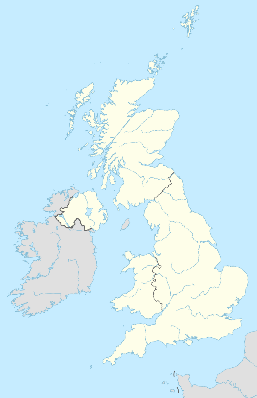
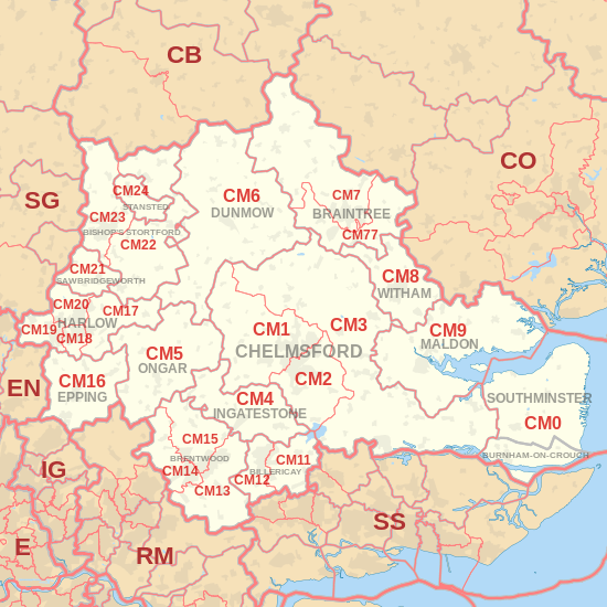
The CM postcode area, also known as the Chelmsford postcode area,[2] is a group of 25 postcode districts in England, within 16 post towns. These cover central Essex (including Chelmsford, Harlow, Brentwood, Billericay, Braintree, Burnham-on-Crouch, Dunmow, Epping, Ingatestone, Maldon, Ongar, Southminster, Stansted and Witham), plus a small part of east Hertfordshire (including Bishop's Stortford and Sawbridgeworth) and a very small part of the London Borough of Havering.
| Chelmsford postcode area | |
|---|---|
 CM | |
| Postcode area | CM |
| Postcode area name | Chelmsford |
| Post towns | 16 |
| Postcode districts | 28 |
| Postcode sectors | 103 |
| Postcodes (live) | 17,864 |
| Postcodes (total) | 27,233 |
| Statistics as at May 2020[1] | |
The southern part of the CM7 district for Braintree was recoded to CM77 in 2002.[3]
Coverage
The Stansted post town (CM24) is entirely surrounded by the Bishop's Stortford post town (CM22 and CM23).[2] The approximate coverage of the postcode districts:
| Postcode district | Post town | Coverage | Local authority area(s) |
|---|---|---|---|
| CM0 | SOUTHMINSTER | Southminster, Bradwell, Tillingham, Asheldham, Dengie | Maldon |
| BURNHAM-ON-CROUCH | Burnham-on-Crouch, Tillingham | ||
| CM1 | CHELMSFORD | Chelmsford, Writtle | Chelmsford, Uttlesford |
| CM2 | CHELMSFORD | Chelmsford | Chelmsford |
| CM3 | CHELMSFORD | Hatfield Peverel, South Woodham Ferrers, North Fambridge, Cold Norton, Boreham, Maylandsea | Chelmsford, Maldon, Braintree, Uttlesford |
| CM4 | INGATESTONE | Blackmore, Fryerning, Ingatestone, Margaretting, Stock | Brentwood, Chelmsford, Epping Forest |
| CM5 | ONGAR | Chipping Ongar, High Ongar, Bobbingworth, Moreton, The Lavers, The Rodings | Epping Forest |
| CM6 | DUNMOW | Great Dunmow, Felsted | Uttlesford, Chelmsford |
| CM7 | BRAINTREE | Braintree, Finchingfield, Great Bardfield | Braintree, Uttlesford |
| CM8 | WITHAM | Witham | Braintree, Maldon |
| CM9 | MALDON | Maldon, Tollesbury, Tolleshunt D'Arcy, Tolleshunt Knights | Maldon |
| CM11 | BILLERICAY | Billericay (East), Great Burstead | Basildon, Chelmsford |
| CM12 | BILLERICAY | Billericay (West), Little Burstead | Basildon, Brentwood |
| CM13 | BRENTWOOD | Brentwood, East Horndon, Great Warley, Herongate, Hutton, Ingrave, Little Warley, West Horndon | Brentwood, Basildon, Havering |
| CM14 | BRENTWOOD | Brentwood, Warley | Brentwood, Havering |
| CM15 | BRENTWOOD | Brentwood, Doddinghurst, Kelvedon Hatch, Mountnessing, Shenfield, Stondon Massey, Pilgrims Hatch | Brentwood |
| CM16 | EPPING | Epping, Theydon Bois, North Weald | Epping Forest |
| CM17 | HARLOW | Harlow, Old Harlow, Matching, Matching Tye, Matching Green, Church Langley | Harlow, Epping Forest, Uttlesford |
| CM18 | HARLOW | Harlow | Harlow, Epping Forest |
| CM19 | HARLOW | Harlow, Roydon | Harlow, Epping Forest |
| CM20 | HARLOW | Harlow, Gilston | Harlow, East Hertfordshire |
| CM21 | SAWBRIDGEWORTH | Sawbridgeworth | East Hertfordshire, Epping Forest |
| CM22 | BISHOP'S STORTFORD | Bishop's Stortford, Sheering | Uttlesford, East Hertfordshire, Epping Forest |
| CM23 | BISHOP'S STORTFORD | Bishop's Stortford, Thorley, Manuden | East Hertfordshire, Uttlesford |
| CM24 | STANSTED | Stansted Mountfitchet, Stansted Airport | Uttlesford |
| CM77 | BRAINTREE | Braintree, Great Notley, Rayne | Braintree, Uttlesford |
| CM92 | CHELMSFORD | Shop Direct | non-geographic[4] |
| CM98 | CHELMSFORD | Department for Work and Pensions | non-geographic[4] |
| CM99 | CHELMSFORD | Selectapost, International Financial Data Services Group | non-geographic[4] |
Map
gollark: SQLite - praise be - does very robust testing, they have a thing which simulates malloc failure after varying numbers of calls during their tests.
gollark: Un-anyway, I don't think it's worth not critically failing unless you write general important "infrastructure" stuff like SQLite or embedded code.
gollark: Anyway, it is *very irritating* working on a tool which you quite badly want but which you aren't competent enough to make as you want and in reasonable time.
gollark: Doesn't Haskell just allocate itself a TB of virtual memory?
gollark: I don't think most code is written to handle out of memory issues ever now?
References
- "ONS Postcode Directory Version Notes" (ZIP). National Statistics Postcode Products. Office for National Statistics. May 2020. Table 2. Retrieved 19 June 2020. Coordinates from mean of unit postcode points, "Code-Point Open". OS OpenData. Ordnance Survey. February 2012. Retrieved 21 April 2012.
- Royal Mail, Address Management Guide, (2004)
- "Royal Mail Update 34". Beacon Dodsworth. Retrieved 23 August 2015.
- "Non Geographic Codes" (PDF). Royal Mail Address Management Unit. July 2012. Archived from the original (PDF) on 16 September 2012. Retrieved 20 December 2012.
External links
This article is issued from Wikipedia. The text is licensed under Creative Commons - Attribution - Sharealike. Additional terms may apply for the media files.
