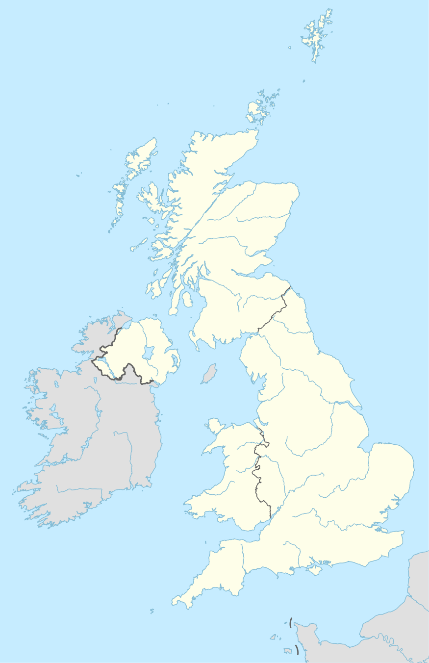
TA postcode area
The TA postcode area, also known as the Taunton postcode area,[2] is a group of 24 postcode districts in South West England, within 19 post towns. These cover western Somerset (including Taunton, Bridgwater, Burnham-on-Sea, Chard, Crewkerne, Dulverton, Highbridge, Hinton St George, Ilminster, Langport, Martock, Merriott, Minehead, Montacute, Somerton, South Petherton, Stoke-sub-Hamdon, Watchet and Wellington), plus very small parts of Dorset and Devon.
| Taunton postcode area | |
|---|---|
 TA | |
| Postcode area | TA |
| Postcode area name | Taunton |
| Post towns | 19 |
| Postcode districts | 24 |
| Postcode sectors | 67 |
| Postcodes (live) | 11,711 |
| Postcodes (total) | 14,693 |
| Statistics as at May 2020[1] | |
Coverage
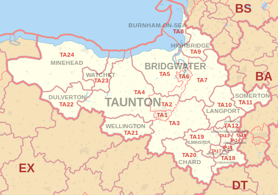
The approximate coverage of the postcode districts:
| Postcode district | Post town | Coverage | Local authority area(s) |
|---|---|---|---|
| TA1 | TAUNTON | Taunton, Comeytrowe, Bishops Hull, Holway, Wilton, Lambrook, | Somerset West and Taunton |
| TA2 | TAUNTON | Taunton, Norton Fitzwarren, Cheddon Fitzpaine, Kingston St Mary, Monkton Heathfield, West Monkton | Somerset West and Taunton, Sedgemoor |
| TA3 | TAUNTON | North Curry, Isle Abbots, Stoke St Mary, Stoke St Gregory, Fivehead, Churchinford, Trull | Somerset West and Taunton, South Somerset, Sedgemoor |
| TA4 | TAUNTON | Bicknoller, Bishops Lydeard, Crowcombe, Milverton, West Bagborough, Williton, Wiveliscombe | Somerset West and Taunton |
| TA5 | BRIDGWATER | Cannington, Nether Stowey, Over Stowey, Spaxton, Fiddington, | Sedgemoor, Somerset West and Taunton |
| TA6 | BRIDGWATER | Bridgwater, North Petherton, Wembdon | Sedgemoor |
| TA7 | BRIDGWATER | Puriton, Polden Hills, Westonzoyland, Middlezoy, Shapwick, Catcott, Ashcott, Chedzoy | Sedgemoor, Somerset West and Taunton, South Somerset |
| TA8 | BURNHAM-ON-SEA | Burnham on Sea, Berrow, Brean, Steep Holm | Sedgemoor |
| TA9 | HIGHBRIDGE | Highbridge, West Huntspill, Brent Knoll | Sedgemoor |
| TA10 | LANGPORT | Langport, Curry Rivel, Huish Episcopi, Hambridge and Westport | South Somerset |
| TA11 | SOMERTON | Somerton, Keinton Mandeville, Charlton Mackrell, Charlton Adam | South Somerset, Mendip |
| TA12 | MARTOCK | Martock, Kingsbury Episcopi, Ash, Stembridge, Coat, Stapleton, Witcombe | South Somerset |
| TA13 | SOUTH PETHERTON | South Petherton, Over Stratton, Lopen, East Lambrook, West Lambrook | South Somerset |
| TA14 | STOKE-SUB-HAMDON | Stoke-sub-Hamdon, Norton-sub-Hamdon, Chiselborough | South Somerset |
| TA15 | MONTACUTE | Montacute | South Somerset |
| TA16 | MERRIOTT | Merriott | South Somerset |
| TA17 | HINTON ST. GEORGE | Hinton St George, Dinnington | South Somerset |
| TA18 | CREWKERNE | Crewkerne, Haselbury Plucknett, West Chinnock, Misterton, North Perrott | South Somerset, Dorset |
| TA19 | ILMINSTER | Ilminster, Ashill, Ilton, Dowlish Wake, Shepton Beauchamp, Donyatt, Whitelackington | South Somerset |
| TA20 | CHARD | Chard, Buckland St Mary, Forton, Combe St Nicholas, Tatworth, Thorncombe | South Somerset, Dorset, Somerset West and Taunton |
| TA21 | WELLINGTON | Wellington, West Buckland, Rockwell Green, Tonedale | Somerset West and Taunton, Mid Devon |
| TA22 | DULVERTON | Dulverton, Brompton Regis, Exebridge, Exton | Somerset West and Taunton |
| TA23 | WATCHET | Watchet, Washford, Roadwater, Luxborough, Doniford, Treborough | Somerset West and Taunton |
| TA24 | MINEHEAD | Minehead, Porlock, Dunster, Wheddon Cross, Exford, Blue Anchor | Somerset West and Taunton |
Map
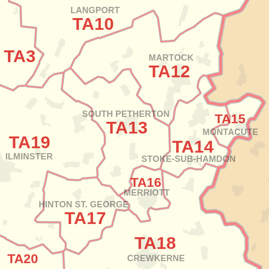
Detailed map of postcode districts and post towns in and around South Petherton
gollark: It's not like they would magically beat x86 designs massively if Qualcomm wasn't doing anything.
gollark: The newer A7x cores are relatively okay ish in IPC apparently.
gollark: Also, I think they just use slightly customized ARM-designed cores anyway...
gollark: Yes they do.
gollark: Yep.
References
- "ONS Postcode Directory Version Notes" (ZIP). National Statistics Postcode Products. Office for National Statistics. May 2020. Table 2. Retrieved 19 June 2020. Coordinates from mean of unit postcode points, "Code-Point Open". OS OpenData. Ordnance Survey. February 2012. Retrieved 21 April 2012.
- Royal Mail, Address Management Guide, (2004)
External links
This article is issued from Wikipedia. The text is licensed under Creative Commons - Attribution - Sharealike. Additional terms may apply for the media files.