Street, Somerset
Street is a village and civil parish in the county of Somerset, England. The 2011 census recorded the parish as having a population of 11,805.[1] It is situated on a dry spot in the Somerset Levels, at the end of the Polden Hills, 2 miles (3.2 km) south-west of Glastonbury. There is evidence of Roman occupation. Much of the history of the village is dominated by Glastonbury Abbey until the Dissolution of the Monasteries, and a 12th-century causeway from Glastonbury was built to transport local Blue Lias stone from what is now Street to rebuild the Abbey.
| Street | |
|---|---|
 Church of the Holy Trinity, Street | |
 Street Location within Somerset | |
| Population | 11,805 [1] |
| OS grid reference | ST483363 |
| District | |
| Shire county | |
| Region | |
| Country | England |
| Sovereign state | United Kingdom |
| Post town | STREET |
| Postcode district | BA16 |
| Dialling code | 01458 |
| Police | Avon and Somerset |
| Fire | Devon and Somerset |
| Ambulance | South Western |
| UK Parliament | |
The Society of Friends had become established there by the mid-17th century. One Quaker family, the Clarks, started a business in sheepskin rugs, woollen slippers and, later, boots and shoes. This became C&J Clark which still has its headquarters in Street, but shoes are no longer manufactured there. Instead, in 1993, redundant factory buildings were converted to form Clarks Village, the first purpose-built factory outlet in the United Kingdom. The Shoe Museum provides information about the history of Clarks and footwear manufacture in general.
The Clark family's former mansion and its estate at the edge of the town are now owned by Millfield School, an independent co-educational boarding school. Street is also home to Crispin School and Strode College.
To the north of Street is the River Brue, which marks the boundary with Glastonbury. South of Street are the Walton and Ivythorn Hills and East Polden Grasslands biological Sites of Special Scientific Interest. Street has two public swimming pools, one indoor which is part of the Strode complex, and the outdoor lido, Greenbank. Strode Theatre provides a venue for films, exhibitions and live performances. The Anglican Parish Church of The Holy Trinity dates from the 14th century and has been designated by English Heritage as a Grade I listed building.
History
The settlement's earliest known name is Lantokay, meaning the sacred enclosure of Kea, a Celtic saint.[2] The place-name 'Street' is first attested in Anglo-Saxon charters from 725 and 971, where it appears as Stret. It appears as Strete juxta Glastone in a charter from 1330 formerly in the British Museum. The word is the Old English straet meaning 'Roman road'.[3]
The centre of Street is where Lower Leigh hamlet was, and the road called Middle Leigh and the community called Overleigh are to the south of the village. In the 12th century, a causeway from Glastonbury was built to transport stone from what is now Street for rebuilding Glastonbury Abbey after a major fire in 1184.[2] The causeway is about 100 yards (90 m) north of a Roman road running north from Ilchester. It will be seen that the name of the village predates the building of the causeway by more than four hundred years, and so the village is named after the Roman road and not the causeway.
The parish of Street was part of the Whitley Hundred.[4]
Quarries of the local blue lias stone were worked from as early as the 12th century to the end of the 19th century. It is a geological formation in southern England, part of the Lias Group. The Blue Lias consists of a sequence of limestone and shale layers, laid down in latest Triassic and early Jurassic times, between 195 and 200 million years ago. Its age corresponds to the Rhaetian to lower Sinemurian stages of the geologic timescale, thus fully including the Hettangian stage. It is the lowest of the three divisions of the Lower Jurassic period and, as such, is also given the name Lower Lias.[5] It consists of thin blue argillaceous, or clay-like, limestone. The Blue Lias contains many fossils, especially ammonites.[6] Fossils discovered in the lias include many ichthyosaurs, one of which has been adopted as the badge of Street.[7] There is a display of Street fossils in the Natural History Museum in London.
The churchyard of the Parish Church has yielded one Iron Age coin, however the origin and significance is unclear,[2] although the Dobunni were known to have produced coins in the area.[8] A number of Roman pottery fragments, now in the Museum of Somerset. Remains of Roman villas exist on the south edge of Street near Marshalls Elm and Ivythorn. Buried remains of a Roman road were excavated in the early 20th century on the flood-plain of the river Brue between Glastonbury and Street.[2] The parish churchyard is on the first flood-free ground near the river Brue and was probably the first land to be inhabited. The form of the large churchyard suggests a lan, a sacred area of a kind that was built in the first half of the 6th century.[9] Llan or Lan is a common place name element in Brythonic languages such as Welsh, Cornish, Breton, Cumbric, and possibly Pictish. The original meaning of llan in Welsh is "an enclosed piece of land", but it later evolved to mean the parish surrounding a church.[10]
One biography of St Gildas has the saint spending some time in Glastonbury Abbey, and moving to a site by the river, where he built a chapel to the Holy Trinity and there died. The Parish Church, now Holy Trinity, has at times been known as St Gildas' church.[9] Glastonbury Abbey controlled Street until the Dissolution.
Sharpham Park is a 300-acre (1.2 km2) historic park, approximately 2 miles (3.2 km) west of Street, which dates back to the Bronze Age. The first known reference is a grant by King Edwy to the then Aethelwold in 957. In 1191 Sharpham Park was conferred by the soon-to-be King John to the Abbots of Glastonbury, who remained in possession of the park and house until the Dissolution of the Monasteries in 1539. From 1539 to 1707 the park was owned by the Duke of Somerset, Sir Edward Seymour, brother of Queen Jane; the Thynne family of Longleat, and the family of Sir Henry Gould. Edward Dyer was born here in 1543. The house is now a private residence and Grade II* listed building.[11] It was the birthplace of Sir Edward Dyer (died 1607) an Elizabethan poet and courtier, the writer Henry Fielding (1707–54), and the cleric William Gould.
Ivythorn Manor on Pages Hill was a medieval monastic house. It was rebuilt in 1488 for Abbot John Selwood of Glastonbury Abbey. After the Dissolution of the Monasteries it became a manor house owned by the Marshall and Sydenham families. Sir John Sydenham added a wing 1578 which was later demolished. By 1834 the house was largely ruined until its restoration around 1904, and a west wing was added in 1938. It is a Grade II* listed building.[12]
Governance
The parish council is responsible for some local issues, and sets an annual precept (local rate) to cover its council's operating costs. The parish council evaluates local planning applications and works with the local police, district council officers, and neighbourhood watch groups on matters of crime, security, and traffic. The parish council also initiates projects for the maintenance and repair of parish facilities, and consults with the district council on the maintenance, repair, and improvement of highways, drainage, footpaths, public transport, and street cleaning. Conservation (including trees and listed buildings) and environmental issues are also the responsibility of the council. Having previously been part of Street Urban District, the village now falls within the non-metropolitan district of Mendip, which was formed on 1 April 1974, under the Local Government Act 1972,[13] and is responsible for local planning and building control, local roads, council housing, environmental health, markets and fairs, refuse collection and recycling, cemeteries and crematoria, leisure services, parks, and tourism. There are currently three wards of the Mendip Council in Street which elect councillors every four years. As of 2010 the two councillors for Street North are both Liberal Democrats, Street West has one Liberal Democrat councillor and Street South is represented by two councillors one of which is a Liberal Democrat and the other is independent of any political party.[14]
Somerset County Council is responsible for the largest and most expensive local services such as education, social services, libraries, main roads, public transport, policing and fire services, trading standards, waste disposal and strategic planning.
There are three electoral wards in Street (North, South and West). The total population equates to that shown above.
Street is in the Wells parliamentary constituency, which elects one Member of Parliament (MP) by the first past the post system. The current MP is James Heappey, elected in 2015, of the Conservative Party.[15] Street is twinned with Isny im Allgäu, a town in south-eastern Baden-Württemberg, (Germany),[16] and Notre Dame de Gravenchon in Normandy, France.[17] Both twinnings are announced on the signs that welcome visitors to Street.
Geography
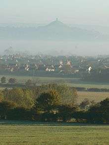
The River Brue marks the boundary with Glastonbury, to the north of Street. At the time of King Arthur, the Brue formed a lake just south of the hilly ground on which Glastonbury stands. This lake is one of the locations suggested by Arthurian legend as the home of the Lady of the Lake. Pomparles Bridge stood at the western end of this lake, guarding Glastonbury from the south, and it was here that Sir Bedivere is thought to have thrown the sword Excalibur into the waters after King Arthur fell at the Battle of Camlann.[18] The old bridge was replaced by a reinforced concrete arch bridge in 1911.[19]
Before the 13th century, the direct route to the sea at Highbridge was blocked by gravel banks and peat near Westhay.[20] The course of the river partially encircled Glastonbury from the south, around the western side (through Beckery), and then north through the Panborough-Bleadney gap in the Wedmore-Wookey Hills, to join the River Axe just north of Bleadney. This route made it difficult for the officials of Glastonbury Abbey to transport produce from their outlying estates to the Abbey, and when the valley of the river Axe was in flood it backed up to flood Glastonbury itself. Sometime between 1230 and 1250, a new channel was constructed westwards into Meare Pool north of Meare, and further westwards to Mark Moor. The Brue Valley Living Landscape is a conservation project based on the Somerset Levels and Moors and managed by the Somerset Wildlife Trust.[21]
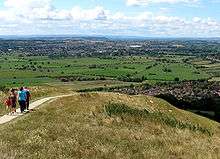
The Walton and Ivythorn Hills biological Site of Special Scientific Interest south of the town lies at the end of the Polden Hills. This site is owned and managed by the National Trust. Walton and Ivythorn Hills support a complex mosaic of semi-natural habitats which includes unimproved calcareous grassland, dense and scattered scrub and broadleaved woodland. Structural diversity within the habitats, together with the extensive areas of sheltered wood-edge and scrub-edge margins provide ideal conditions for many species of invertebrate. Butterflies, leafhoppers, spiders and soldier flies are particularly well represented. The great green bush cricket (Tettigonia viridissima) is also of interest.[22] It is adjacent to the East Polden Grasslands which has typical examples of species-rich, unimproved, calcareous grassland with scrub and amongst the many plant species found in this habitat is the early gentian (Gentianella anglica), which is endemic to Britain. Its other main interest lies in its suitability as a habitat for the large blue butterfly (Phengaris arion), which has been successfully reintroduced onto the site. There are two nationally scarce grasshopper species present; rufous grasshopper (Gomphocerippus rufus) and woodland grasshopper (Omocestus rufipes). Several nationally scarce species of moth, beetle, bee and ant also occur.[23]
Street Heath is a nature reserve, managed by Somerset Wildlife Trust, and has outstanding examples of communities which were once common on the Somerset Levels. The vegetation consists of wet and dry heath, species-rich bog and carr woodland, with transitions between all these habitats. Rare ferns present include marsh fern (Thelypteris palustris) and royal fern (Osmunda regalis). Old peat workings and rhynes have a wetland community which includes bulrush (Typha latifolia), yellow flag iris (pseudacorus), cyperus-like sedge (Carex pseudocyperus) and lesser bur-reed (Sparganium natans). Insects recorded include 33 species of butterflies, 200 moths and 12 grasshoppers and crickets, with several notable rarities. Birds breeding in the carr woodland include the local willow tit[24]
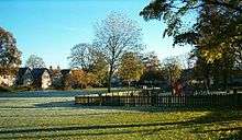
Merriman Park is named after Nathaniel James Merriman. He was Curate then Vicar of Street,[25] until he emigrated to South Africa. He rose to become Archdeacon of Grahamstown then Dean of Cape Town before being elevated the Episcopate.
Climate
Along with the rest of South West England, Street has a temperate climate which is generally wetter and milder than the rest of the country.[26] The annual mean temperature is approximately 10 °C (50.0 °F). Seasonal temperature variation is less extreme than most of the United Kingdom because of the adjacent sea temperatures. The summer months of July and August are the warmest with mean daily maxima of approximately 21 °C (69.8 °F). In winter mean minimum temperatures of 1 °C (33.8 °F) or 2 °C (35.6 °F) are common.[26] In the summer the Azores high pressure affects the south-west of England, however convective cloud sometimes forms inland, reducing the number of hours of sunshine. Annual sunshine rates are slightly less than the regional average of 1,600 hours.[26] In December 1998 there were 20 days without sun recorded at Yeovilton. Most of the rainfall in the south-west is caused by Atlantic depressions or by convection. Most of the rainfall in autumn and winter is caused by the Atlantic depressions, which is when they are most active. In summer, a large proportion of the rainfall is caused by sun heating the ground leading to convection and to showers and thunderstorms. Average rainfall is around 700 mm (28 in). About 8–15 days of snowfall is typical. November to March have the highest mean wind speeds, and June to August have the lightest winds. The predominant wind direction is from the south-west.[26]
C. and J. Clark Ltd
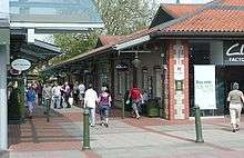
The Society of Friends established itself here in the mid-17th century, and among the close-knit group of Quaker families were the Clarks: Cyrus Clark started a business in sheepskin rugs, later joined by his brother James, who introduced the production of woollen slippers and then boots and shoes.[27] Under James's son, William, the business flourished, but most of the profits were ploughed back into employee welfare, housing and education.
C&J Clark still has its headquarters in Street, behind a frontage that includes the clock tower and water tower,[28] but shoes are no longer manufactured there. Instead, in 1993, redundant factory buildings were converted to form Clarks Village, the first purpose-built factory outlet in the United Kingdom.[29] Despite strong concerns being voiced by local retailers at the time, the retail outlets have not led to a demise of the existing shops. The Shoe Museum provides information about the history of Clarks and footwear manufacture in general,[30] and a selection of shop display showcards from the 1930s, the 1950s and the 1960s,[31] and television advertisements.[32]
The Clark family mansion and its estate at the edge of the village are now owned by Millfield School. The company, through the Society of Friends, also had its own small sanatorium and convalescent home on Ivythorn Hill overlooking the town. In 1931, the chalet-style building was leased to the Youth Hostel Association and became the first youth hostel in Somerset. It is still used for this purpose.[33]
Transport
In Roman times Street was close to the route of the Fosse Way and is now on the route of the modern A39 road which runs from Bath to Cornwall, and the A361.
Glastonbury and Street railway station was the biggest station on the original Somerset and Dorset Joint Railway main line from Highbridge to Evercreech Junction until closed in 1966 under the Beeching axe. Opened in 1854 as Glastonbury, and renamed in 1886, it had three platforms, two for Evercreech to Highbridge services and one for the branch service to Wells. The station had a large goods yard controlled from a signal box.[34] The site is now a timber yard for a local company. The nearest stations are now around 13 miles away, at Castle Cary and Bridgwater. Replica level crossing gates have been placed at the old station entrance.[35]
Education
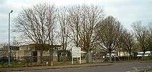
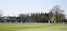
Primary infant/junior schools include Avalon, Brookside, Hindhayes, and Elmhurst.
Crispin School is a secondary school teaching 11- to 16-year-old students from Street and many local villages. It has 1084[36] students between the ages of 11 and 16 years enrolled. In 1997 it became the first Beacon School in Somerset. It is a Technology College and has a second specialism as a Language College. The school shares its campus with Strode College, a tertiary institution and further education college which provides education for 16+ students after they leave secondary school, these courses are usually A-levels or Business and Technology Education Councils (BTECs). The college also provides education for older/mature students, and provides some university level courses.[37] The college is part of The University of Plymouth Colleges network.
At the edge of town is Millfield School, an independent co-educational boarding school which currently caters for 1,260 pupils, of which 910 are boarders.[38] It was founded in 1935 by Boss Meyer, in the house and grounds originally owned by the Clark family, who owned and ran the major shoe manufacturer Clarks.[39]
Sport and leisure
Street has a Non-League football club Street F.C. who play at The Tannery.
Street has two public swimming pools, one indoor and one outdoor. The indoor pool forms part of the Strode complex. The outdoor pool, Greenbank, is open daily from early May until mid September each year.[40]
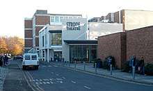
The only single use cinema in Street was closed down and converted into a nightclub in the 1990s. Strode Theatre, linked to the Crispin School and Strode College complex, is now the only place to see films, exhibitions and live performances.[41] It opened on 5 October 1963 with a performance by the Bournemouth Symphony Orchestra.[42] In 1999 the theatre was expanded with a new foyer, bar and box office along with improved rehearsal space and stage access, at a cost of £750,000 by the Steel, Coleman Davis partnership who received an award for the design.[43] The expansion was funded by the Arts Council England.[44]
The town is on the route of the Samaritans Way South West.
Religious sites
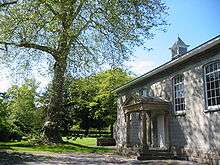
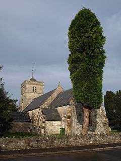
The Anglican Parish Church of The Holy Trinity dates from the 14th century but underwent extensive restoration in the 19th century. It has been designated by English Heritage as a Grade I listed building.[45] The chancel pre dates the rest of the building, having been built about 1270. The first recorded Rector was John de Hancle in 1304.[46] The parish is linked with Street Mission Church in Vestry Road and the church in Walton.[47] There is also a Baptist church on Glaston Road.[48] The Quaker Friends Meeting House was built in 1850, by J. Francis Cottrell of Bath.[49] The United Reformed Church was built on High Street in 1854–55 and Street Methodist Church built on Leigh Road in 1893.[50]
Notable people
- Helen Chamberlain, an English television presenter, was born in Street in 1967.[51]
- Henry John "Harry" Patch (1898-2009), the last surviving 'Tommy' from the First World War, moved to Street in the early 1940s, and ran a plumbing company in the town until his retirement at age 65.[52]
- Jaye Jacobs, actress[53]
- John Hinde was born in Street before going on to become a photographer whose idealistic and nostalgic style influenced the art of postcard photography and was widely known for his meticulously planned shoots.[54]
- John X. Merriman was born in Street in 1841, His parents were Nathaniel James Merriman, curate of the parish of Street and later third Bishop of Grahamstown, and the former Julia Potter. He emigrated to the Cape Colony with his parents in 1849, aged 8. He was the last prime minister of the Cape Colony before the formation of the Union of South Africa in 1910.[25]
- Laurence Housman, an English playwright, writer and illustrator, lived in Street for 35 years before his death in 1959. He was a younger brother of the poet A.E. Housman.[55]
- Clemence Housman, an author, illustrator and suffragette, lived with her brother Laurence in Street.
- Edwin Edwards (organist), organist, composer, Director of Music at Rugby College, was born in Street in 1830.[56]
- Catherine Impey, the founder, editor, and publisher of an antirace journal Anti-Caste (1888–1895) was born in Street in 1847. Catherine rejected race, caste, and gender violence. She was friends with Frederick Douglass, Ida B. Wells and other African Americans with whom she continued a global movement against racism, casteism, and gender problems. She died in 1923.[57]
Freedom of the Parish
The following people and military units have received the Freedom of the Parish of Street.
References
- "Street Parish (2011)". Neighbourhood Statistics. Office for National Statistics. Retrieved 1 January 2014.
- Gathercole, Clare. "Street" (PDF). Somerset Urban Archaeological Survey. Somerset County Council. Archived from the original (PDF) on 17 July 2011. Retrieved 21 August 2009.
- Eilert Ekwall, The Concise Oxford Dictionary of English Place-names, p.450.
- "Somerset Hundreds". GENUKI. Retrieved 22 October 2011.
- Ambrose, K.; 2001: The lithostratigraphy of the Blue Lias Formation (Late Rhaetian–Early Sinemurian) in the southern part of the English Midlands, Proceedings of the Geologists' Association 112(2), pp. 97–110.
- "The History Behind the ichthyosaur logo". Street Parish Council. Retrieved 21 August 2009.
- "Palaeontological Association Review Seminar" (PDF). The Palaeontological Association. Retrieved 21 August 2009.
- "Iron Age Coins". Cardiff University. Retrieved 2 September 2010.
- "The archaeology of Street Churchyard". Holy Trinity Street and Walton. Archived from the original on 14 August 2007. Retrieved 21 August 2009.
- "Llan". Place names. BBC Wales. Retrieved 2 September 2010.
- Historic England. "Abbots Sharpham and Sharpham Park Farmhouse (1345069)". National Heritage List for England. Retrieved 25 November 2006.
- Historic England. "Ivythorn Manor (1176171)". National Heritage List for England. Retrieved 3 July 2010.
- "Street UD". A vision of Britain Through Time. University of Portsmouth. Retrieved 4 January 2014.
- "Your Councillors". Mendip District Council. Archived from the original on 4 March 2011. Retrieved 2 September 2010.
- "Wells". 2010 General Election Results. BBC. Retrieved 2 September 2010.
- "Twin Towns". Teignmouth Twinning Association. Archived from the original on 20 February 2012. Retrieved 7 October 2012.
- "British and French Twin Towns". France Magazine. Retrieved 22 August 2010.
- "Pomparles Bridge". ArthurianAdventure.com. Archived from the original on 17 October 2008. Retrieved 11 November 2008.
- "Pomparles Bridge, Northover, Glastonbury". Somerset Historic Environment Record. Somerset County Council. Retrieved 4 July 2010.
- "Meare and Ferran Mere". Sacred Sites around Glastonbury. Archived from the original on 2 August 2012. Retrieved 1 November 2008.
- "Brue Valley Living Landscape". Somerset Wildlife Trust. Retrieved 2 July 2010.
- "Walton and Ivythorn Hills" (PDF). English Nature. Retrieved 21 August 2006.
- "East Polden Grasslands" (PDF). English Nature. Retrieved 12 August 2006.
- "Street Heath" (PDF). English Nature. Retrieved 21 August 2006.
- "The Merriman Family" (Word). Street Society. Retrieved 7 June 2012.
- "South West England: climate". Met Office. Archived from the original on 5 June 2011. Retrieved 14 March 2010.
- Scott, Shane (1995). The hidden places of Somerset. Aldermaston: Travel Publishing Ltd. p. 82. ISBN 1-902007-01-8.
- Historic England. "Main roadside frontage to Clarks Factory, Clock Tower, 5 bay right return and Water Tower (1058755)". National Heritage List for England. Retrieved 23 March 2008.
- "Street". Visit Somerset. Archived from the original on 5 May 2013. Retrieved 6 June 2012.
- "Shoe Museum". Information Britain. Retrieved 12 July 2009.
- "The Shoe Museum, Street". Nothing to see here. Retrieved 12 July 2009.
- "The Shoe Museum". Somerset Tourist Guide. Archived from the original on 9 May 2008. Retrieved 12 July 2009.
- "Youth Hostel, Street". Youth Hostel Association. Retrieved 2 July 2010.
- "Glastonbury". Somerset and Dorset Joint Railway. Archived from the original on 6 May 2011. Retrieved 3 July 2010.
- Nevard, Chris. "Glastonbury after closure". Archived from the original on 16 December 2009. Retrieved 3 July 2010.
- "Crispin School". Ofsted. Archived from the original on 16 February 2011. Retrieved 1 April 2009.
- "University Level courses" (PDF). Strode College. Archived from the original (PDF) on 28 November 2009. Retrieved 5 July 2009.
- "Millfield School". Millfield School. Retrieved 2 July 2010.
- "Millfield in its Infancy" (Word). Street Society. Retrieved 7 June 2012.
- "Greenbank Pool". Greenbank Pool. Retrieved 21 August 2009.
- "Strode Theatre". Strode Theatre. Retrieved 21 August 2009.
- "Strode Theatre". Total Travel.com. Archived from the original on 31 January 2010. Retrieved 4 July 2010.
- "Strode Theatre". Steel Coleman Davis Partnership. Retrieved 16 September 2012.
- "Strode Theatre". Bailey partnership. Retrieved 16 September 2012.
- Historic England. "Church of The Holy Trinity (1058753)". National Heritage List for England. Retrieved 23 March 2008.
- "History". Holy Trinity Street and Walton. Retrieved 17 May 2009.
- "Our Churches". Hily Trinity Street and Walton. Archived from the original on 20 July 2010. Retrieved 2 September 2010.
- "Street Baptist Church". Street Baptist Church. Retrieved 2 September 2010.
- Historic England. "Friends Meeting House (1308052)". National Heritage List for England. Retrieved 23 March 2008.
- "Parishes: Street | British History Online". British-history.ac.uk. Retrieved 12 January 2020.
- "Helen Chamberlain". IMDb. Retrieved 3 July 2010.
- "Obituary: Private Harry Patch". The Daily Telegraph. London. 25 July 2009. Retrieved 25 July 2009.
- "Jaye Jacobs". Holby.tv. Archived from the original on 25 May 2010. Retrieved 3 July 2010.
- Sarsby, Jacqueline (3 February 1998). "Obituaries: John Hinde". The Independent. Retrieved 3 July 2010.
- "Catalogue of Laurence Housman's works" (Word). Street Society. Retrieved 7 June 2012.
- Humphreys, Maggie; Evans, Robert (1997). Dictionary of Composers for the Church in Great Britain and Ireland. A&C Black. p. 101. ISBN 9780720123302.
- "Catherine Impey of Street, Somerset, and her radical anti-racist newspaper". Quaker Strong Rooms. Retrieved 21 September 2016.
- https://www.justplymouth.com/courageous-royal-marine-honoured-by-his-community/
