Vilare Island
Vilare Island (Bulgarian: остров Виларе, romanized: ostrov Vilare, IPA: [ˈɔstrov viˈɫarɛ]) is the low ice-free island in the Onogur group off the northwest coast of Robert Island in the South Shetland Islands, Antarctica extending 130 m in east-west direction and 60 m wide. It is separated from Churicheni Island by a 20 m wide passage.
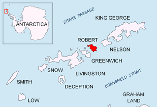 Location of Robert Island in the South Shetland Islands | |
 Vilare Island Location of Vilare Island 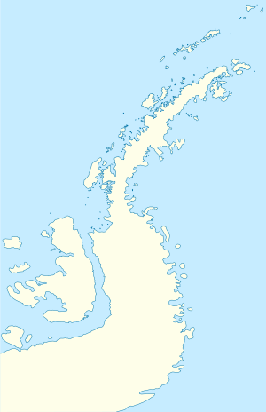 Vilare Island Vilare Island (Antarctic Peninsula) | |
| Geography | |
|---|---|
| Location | Antarctica |
| Coordinates | 62°21′06.5″S 59°40′35″W |
| Archipelago | South Shetland Islands |
| Administration | |
| Administered under the Antarctic Treaty System | |
| Demographics | |
| Population | uninhabited |
The feature is named after the settlement of Vilare in Northern Bulgaria.
Location
Vilare Island is located at 62°21′06.5″S 59°40′35″W, which is 1.7 km north-northeast of Misnomer Point and 290 m west-southwest of Shipot Point. Bulgarian mapping in 2009.
gollark: I was considering buying 16 or so.
gollark: Okay, wow. How much do you want for each?
gollark: 3D prints?
gollark: Suuuuure.
gollark: They rhyme though.
See also
- List of Antarctic and subantarctic islands
Maps
- Livingston Island to King George Island. Scale 1:200000. Admiralty Nautical Chart 1776. Taunton: UK Hydrographic Office, 1968.
- L.L. Ivanov. Antarctica: Livingston Island and Greenwich, Robert, Snow and Smith Islands. Scale 1:120000 topographic map. Troyan: Manfred Wörner Foundation, 2009. ISBN 978-954-92032-6-4 (Second edition 2010, ISBN 978-954-92032-9-5)
- Antarctic Digital Database (ADD). Scale 1:250000 topographic map of Antarctica. Scientific Committee on Antarctic Research (SCAR). Since 1993, regularly upgraded and updated.
References
- Vilare Island. SCAR Composite Antarctic Gazetteer.
- Bulgarian Antarctic Gazetteer. Antarctic Place-names Commission. (details in Bulgarian, basic data in English)
External links
- Vilare Island. Copernix satellite image
This article includes information from the Antarctic Place-names Commission of Bulgaria which is used with permission.

Topographic map of Livingston Island, Greenwich, Robert, Snow and Smith Islands
| General |
| .svg.png) |
|---|---|---|
| Geographic regions | ||
| Waterways | ||
| Famous explorers | ||
This article is issued from Wikipedia. The text is licensed under Creative Commons - Attribution - Sharealike. Additional terms may apply for the media files.