Henfield Rock
Henfield Rock is an offshore rock lying northwest of Robert Island in the South Shetland Islands, Antarctica. It was known to the early 19th century sealers operating from nearby Clothier Harbour, and sometimes included under the name 'Powels Islands' or 'Heywood Islands'.
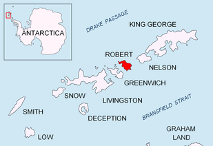 Location of Robert Island in the South Shetland Islands | |
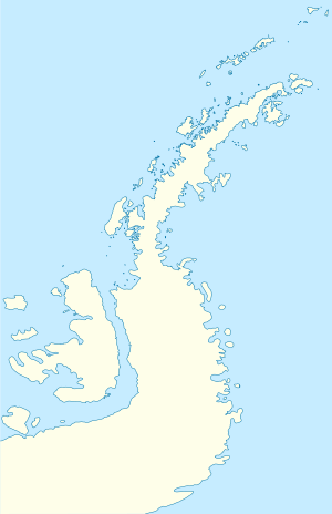 Henfield Rock Location of Henfield Rock  Henfield Rock Henfield Rock (Antarctica) | |
| Geography | |
|---|---|
| Location | Antarctica |
| Coordinates | 62°18′45.8″S 59°35′03.3″W |
| Archipelago | South Shetland Islands |
| Administration | |
| Administered under the Antarctic Treaty System | |
| Demographics | |
| Population | Uninhabited |
The feature is named after Captain Joseph Henfield, Master of the American sealing vessel Catharina that visited the South Shetlands in 1820–21.
Location
The rock is located 2.53 km (1.57 mi) northeast of Catharina Point, 5 km (3.11 mi) east of Heywood Island, 700 m (766 yd) south of Opaka Rocks and 2.81 km (1.75 mi) northwest of Lientur Rocks (British mapping in 1822 and 1968, Chilean in 1971, Argentine in 1980, and Bulgarian in 2009).
gollark: PotatOS automatically turns it on if available for as yet unidentified porpoises.
gollark: Well, CraftOS-PC supports that as an option.
gollark: I think for a basic standard interface you could get away with something like `thing.run(function)` and it could return a handle which lets you stop it and stuff.
gollark: Yes, but then everyone ends up needing to ship one and it's annoying.
gollark: Hey, we could make some sort of limited standard interface for these things.
See also
- Composite Antarctic Gazetteer
- List of Antarctic islands south of 60° S
- SCAR
- Territorial claims in Antarctica
Maps
- Chart of South Shetland including Coronation Island, &c. from the exploration of the sloop Dove in the years 1821 and 1822 by George Powell Commander of the same. Scale ca. 1:200000. London: Laurie, 1822.
- L.L. Ivanov. Antarctica: Livingston Island and Greenwich, Robert, Snow and Smith Islands. Scale 1:120000 topographic map. Troyan: Manfred Wörner Foundation, 2009. ISBN 978-954-92032-6-4
External links

Topographic map of Livingston Island, Greenwich, Robert, Snow and Smith Islands.
This article is issued from Wikipedia. The text is licensed under Creative Commons - Attribution - Sharealike. Additional terms may apply for the media files.