Pyramid Island, South Shetland Islands
Pyramid Island is a conspicuous, pillar-shaped rocky island rising to 205 m (673 ft) off the north entrance to McFarlane Strait in the South Shetland Islands, Antarctica. Its surface area is 9 hectares (22 acres).[1] Cone Rock
(62°25′56.9″S 60°06′08.3″W) is rising to 6 m (19.7 ft) 1.33 km (0.83 mi) south of the island,
2.03 km (1.26 mi) north-northwest of Meade Islands, 2.8 km (1.7 mi) northeast of Williams Point and
1.65 km (1.03 mi) east of Koshava Island, Zed Islands. The vicinity of Pyramid Island was visited on 19 February 1819 during the discovery of the South Shetlands by Captain William Smith in the British brig Williams, and later by early 19th century sealers.
 Pyramid Island (in the central background) from Miziya Peak, Livingston Island with Cone Rock in front of the islet adjacent to Pyramid Island, and Zed Islands on the left and Meade Islands on the right. | |
 Location of McFarlane Strait in the South Shetland Islands | |
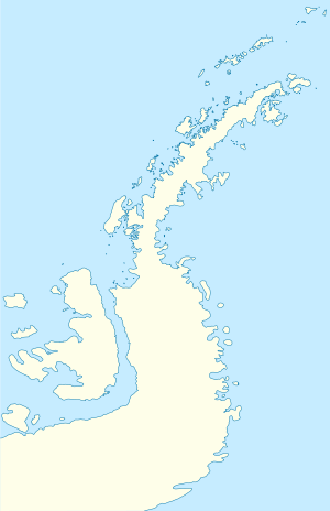 Pyramid Island Location on Antarctic Peninsula  Pyramid Island Location in Antarctica | |
| Geography | |
|---|---|
| Location | Antarctica |
| Coordinates | 62°25′09.9″S 60°05′59.2″W |
| Archipelago | South Shetland Islands |
| Area | 9 ha (22 acres)[1] |
| Highest elevation | 205 m (673 ft) |
| Administration | |
| Administered under the Antarctic Treaty System | |
| Demographics | |
| Population | 0 |
Both the island and the rock were charted and descriptively named by Discovery Investigations personnel in 1935.
Location
Pyramid Island is located at 62°25′09.9″S 60°05′59.2″W which is 4.8 km (3.0 mi) northwest of Duff Point, Greenwich Island, 3.36 km (2.09 mi) north by west of Meade Islands, 3.78 km (2.35 mi) north-northeast of Williams Point and 1.76 km (1.09 mi) northeast of Koshava Island, Zed Islands (British mapping in 1820, 1935, 1948 and 1968, Argentine in 1948 and 1954, Chilean in 1971, Spanish in 1991, and Bulgarian in 2005 and 2009).

See also
- Composite Antarctic Gazetteer
- List of Antarctic islands south of 60° S
- SCAR
- Territorial claims in Antarctica
Map
- L.L. Ivanov et al. Antarctica: Livingston Island and Greenwich Island, South Shetland Islands. Scale 1:100000 topographic map. Sofia: Antarctic Place-names Commission of Bulgaria, 2005.
References
- L.L. Ivanov. Antarctica: Livingston Island and Greenwich, Robert, Snow and Smith Islands. Scale 1:120000 topographic map. Troyan: Manfred Wörner Foundation, 2009. ISBN 978-954-92032-6-4
External links
| General |
| .svg.png) |
|---|---|---|
| Geographic regions | ||
| Waterways | ||
| Famous explorers | ||