Shipot Point
Shipot Point (Bulgarian: нос Шипот, ‘Nos Shipot’ \'nos 'shi-pot\) is the ice-free point on the northwest coast of Robert Island in the South Shetland Islands projecting 630 m northwards, and together with Osenovlag Island and Svetulka Island forming the southwest side of Clothier Harbour. The area was visited by early 19th century sealers.
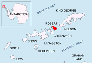
Location of Robert Island in the South Shetland Islands.

Topographic map of Livingston Island, Greenwich, Robert, Snow and Smith Islands.
The point is named after the settlement of Shipot in Northwestern Bulgaria.
Location
Shipot Point is located at 62°21′01.6″S 59°40′13″W, which is 3.63 km northeast of Fort William Point and 1.36 km southwest of Hammer Point. Bulgarian mapping in 2009.
Maps
- Livingston Island to King George Island. Scale 1:200000. Admiralty Nautical Chart 1776. Taunton: UK Hydrographic Office, 1968.
- L.L. Ivanov. Antarctica: Livingston Island and Greenwich, Robert, Snow and Smith Islands. Scale 1:120000 topographic map. Troyan: Manfred Wörner Foundation, 2009. ISBN 978-954-92032-6-4 (Second edition 2010, ISBN 978-954-92032-9-5)
- Antarctic Digital Database (ADD). Scale 1:250000 topographic map of Antarctica. Scientific Committee on Antarctic Research (SCAR), 1993–2016.
gollark: Just use arch Linux BTW.
gollark: iPhones are traitorous devices.
gollark: Hmm. I am now JEALOUSY.
gollark: How fast is your home's e-webbernet connection?
gollark: Over the internet!
References
- Shipot Point. SCAR Composite Antarctic Gazetteer.
- Bulgarian Antarctic Gazetteer. Antarctic Place-names Commission. (details in Bulgarian, basic data in English)
External links
- Shipot Point. Copernix satellite image
This article includes information from the Antarctic Place-names Commission of Bulgaria which is used with permission.
This article is issued from Wikipedia. The text is licensed under Creative Commons - Attribution - Sharealike. Additional terms may apply for the media files.