Patresh Rock
Patresh Rock (Bulgarian: скала Патреш, ‘Skala Patresh’ \ska-'la 'pa-tresh\) is a rock in Clothier Harbour on the northwest coast of Robert Island in the South Shetland Islands, extending 270 m in southeast-northwest direction and 40 m wide. The area was visited by early 19th century sealers.
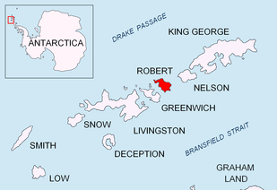 Location of Robert Island in the South Shetland Islands | |
 Patresh Rock Location of Patresh Rock 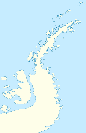 Patresh Rock Patresh Rock (Antarctic Peninsula) | |
| Geography | |
|---|---|
| Location | Antarctica |
| Coordinates | 62°20′41″S 59°39′39″W |
| Archipelago | South Shetland Islands |
| Administration | |
| Administered under the Antarctic Treaty System | |
| Demographics | |
| Population | Uninhabited |
The rock is named after the settlement of Patresh in Northern Bulgaria.
Location
Patresh Rock is located at 62°20′41″S 59°39′39″W, which is 530 m southwest of Hammer Point and 780 m northeast of Shipot Point. British mapping in 1968 and Bulgarian mapping in 2009.
gollark: Modem messages are only received on each tick right?
gollark: With CC dividing *most* time up into ticks I don't think it's a huge issue.
gollark: Neat.
gollark: For my usecases non-constant-timeness *probably* doesn't matter, but it might be worth adding a warning.
gollark: What scripts idea? Also, do I have to rename all potatOS `ecc.lua` things now?
See also
- List of Antarctic and sub-Antarctic islands
- South Shetland Islands
Maps
- Livingston Island to King George Island. Scale 1:200000. Admiralty Nautical Chart 1776. Taunton: UK Hydrographic Office, 1968.
- L.L. Ivanov. Antarctica: Livingston Island and Greenwich, Robert, Snow and Smith Islands. Scale 1:120000 topographic map. Troyan: Manfred Wörner Foundation, 2009. ISBN 978-954-92032-6-4 (Second edition 2010, ISBN 978-954-92032-9-5)
- Antarctic Digital Database (ADD). Scale 1:250000 topographic map of Antarctica. Scientific Committee on Antarctic Research (SCAR). Since 1993, regularly upgraded and updated.
References
- Patresh Rock. SCAR Composite Antarctic Gazetteer.
- Bulgarian Antarctic Gazetteer. Antarctic Place-names Commission. (details in Bulgarian, basic data in English)
External links
- Patresh Rock. Copernix satellite image
This article includes information from the Antarctic Place-names Commission of Bulgaria which is used with permission.

Topographic map of Livingston Island, Greenwich, Robert, Snow and Smith Islands.
This article is issued from Wikipedia. The text is licensed under Creative Commons - Attribution - Sharealike. Additional terms may apply for the media files.