Vergilov Ridge
Vergilov Ridge (Bulgarian: Вергилов хребет, 'Vergilov Hrebet' \ver-'gi-lov 'hre-bet\) is a submarine ridge in South Bay, Livingston Island in the South Shetland Islands, Antarctica. It extends 3.5 km in a southeast-northwest direction between the Vergilov Rocks and the opposite Pimpirev Beach at a depth of over 50 m, with depths exceeding 100 m on both sides of the ridge. It was formed as a frontal moraine of Perunika Glacier between the 13th and 17th centuries.
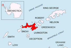
Location of Livingston Island in the South Shetland Islands.
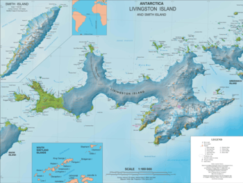
Topographic map of Livingston Island and Smith Island.
The feature takes its name from the Vergilov Rocks.
Location
Vergilov Ridge is centred at 62°37′48″S 60°23′35″W. Spanish mapping in 1991.
gollark: I should probably have my christmoidal gifts ordered soon.
gollark: ++apioform ↓ the apioform below is you
gollark: Oh, hello jabu.
gollark: Oh, that is UTTERLY okay.
gollark: Actually, this is really bad.
See also
Maps
- Isla Livingston: Península Hurd. Mapa topográfico de escala 1:25000. Madrid: Servicio Geográfico del Ejército, 1991. (Map reproduced on p. 16 of the linked work)
- L.L. Ivanov. Antarctica: Livingston Island and Greenwich, Robert, Snow and Smith Islands. Scale 1:120000 topographic map. Troyan: Manfred Wörner Foundation, 2009. ISBN 978-954-92032-6-4
- Antarctica, South Shetland Islands, Livingston Island: Bulgarian Antarctic Base. Sheets 1 and 2. Scale 1:2000 topographic map. Geodesy, Cartography and Cadastre Agency, 2016. (in Bulgarian)
- Antarctic Digital Database (ADD). Scale 1:250000 topographic map of Antarctica. Scientific Committee on Antarctic Research (SCAR). Since 1993, regularly upgraded and updated.
- L.L. Ivanov. Antarctica: Livingston Island and Smith Island. Scale 1:100000 topographic map. Manfred Wörner Foundation, 2017. ISBN 978-619-90008-3-0
References
- Vergilov Ridge. SCAR Composite Antarctic Gazetteer.
- Bulgarian Antarctic Gazetteer. Antarctic Place-names Commission. (details in Bulgarian, basic data in English)
External links
- Vergilov Ridge. Copernix satellite image
This article includes information from the Antarctic Place-names Commission of Bulgaria which is used with permission.
This article is issued from Wikipedia. The text is licensed under Creative Commons - Attribution - Sharealike. Additional terms may apply for the media files.