Valchedram Island
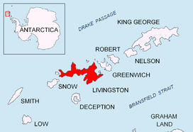
Valchedram Island (Bulgarian: остров Вълчедръм, romanized: ostrov Valchedram, IPA: [ˈɔstrov ˈvɤɫt͡ʃɛdrɐm]) is an ice-free island off the north coast of Livingston Island in the South Shetland Islands, Antarctica extending 280 m (310 yd) in southeast-northwest direction. The feature is named after the town of Valchedram in northwestern Bulgaria.
 Location of Livingston Island in the South Shetland Islands | |
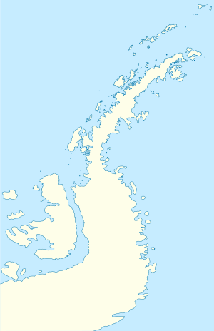
 Valchedram Island Location of Valchedram Island  Valchedram Island Valchedram Island (Antarctic Peninsula) | |
| Geography | |
|---|---|
| Location | Antarctica |
| Coordinates | 62°27′03″S 60°48′48″W |
| Archipelago | South Shetland Islands |
| Administration | |
| Administered under the Antarctic Treaty System | |
| Demographics | |
| Population | Uninhabited |
Location
The island is located 1.55 km (0.96 mi) northwest of Cape Shirreff and 2.2 km (1.4 mi) north-northeast of San Telmo Island (British early mapping in 1822, Chilean in 1971, Argentine in 1980, and Bulgarian in 2009.
gollark: See, I will train GPT-Neo 125M on these IRC logs. Then, using a mildly accursed thing for long-term memory, I will deploy apiary bees. Then, I will add it to ABR.
gollark: No, I mean for my project.
gollark: So it turns out that I accumulated 105MB of IRC logs already.
gollark: You cannot possibly hope to escape.
gollark: Our apiodrones ARE downloading the Nim IRC logs.
See also
- Composite Antarctic Gazetteer
- List of Antarctic islands south of 60° S
- SCAR
- Territorial claims in Antarctica
Maps
- L.L. Ivanov. Antarctica: Livingston Island and Greenwich, Robert, Snow and Smith Islands. Scale 1:120000 topographic map. Troyan: Manfred Wörner Foundation, 2010. ISBN 978-954-92032-9-5 (First edition 2009. ISBN 978-954-92032-6-4)
- Antarctic Digital Database (ADD). Scale 1:250000 topographic map of Antarctica. Scientific Committee on Antarctic Research (SCAR). Since 1993, regularly upgraded and updated.
- L.L. Ivanov. Antarctica: Livingston Island and Smith Island. Scale 1:100000 topographic map. Manfred Wörner Foundation, 2017. ISBN 978-619-90008-3-0
References
- Valchedram Island. SCAR Composite Antarctic Gazetteer
- Bulgarian Antarctic Gazetteer. Antarctic Place-names Commission. (details in Bulgarian, basic data in English)
External links
- Valchedram Island. Copernix satellite image
This article includes information from the Antarctic Place-names Commission of Bulgaria which is used with permission.

Topographic map of Livingston Island and Smith Island
This article is issued from Wikipedia. The text is licensed under Creative Commons - Attribution - Sharealike. Additional terms may apply for the media files.
.svg.png)