Graovo Rocks
Graovo Rocks (Bulgarian: скали Граово, ‘Skali Graovo’ \ska-'li 'gra-o-vo\) is the group of rocks off the north coast of Robert Island in the South Shetland Islands, Antarctica, situated east of Lientur Rocks and southwest of Liberty Rocks, and extending 1.75 km (1.09 mi) in north-south direction and 750 m (820 yd) in east-west direction.
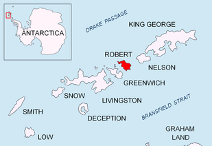 Location of Robert Island in the South Shetland Islands. | |
 Graovo Rocks Location of Graovo Rocks 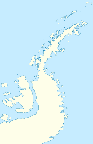 Graovo Rocks Graovo Rocks (Antarctic Peninsula) | |
| Geography | |
|---|---|
| Location | Antarctica |
| Coordinates | 62°19′31″S 59°30′22″W |
| Archipelago | South Shetland Islands |
| Administration | |
| Administered under the Antarctic Treaty System | |
| Demographics | |
| Population | Uninhabited |
The rocks are named after the Graovo region in Western Bulgaria.
Location
Graovo Rocks are centred at 62°19′31″S 59°30′22″W, which is 1.51 km (0.94 mi) north-northeast of Newell Point. British mapping in 1968 and Bulgarian in 2009.
gollark: Isn't it branded "Android 12L" now?
gollark: Why would I tell them that?
gollark: I don't know what those are so they must be bad.
gollark: NewPipe even has nice features like 3x speed playback.
gollark: I'm not sure why you would want non-NewPipe YouTube clients.
See also
- Composite Antarctic Gazetteer
- List of Antarctic and sub-Antarctic islands
- List of Antarctic islands south of 60° S
- SCAR
- Territorial claims in Antarctica
Maps
- L.L. Ivanov. Antarctica: Livingston Island and Greenwich, Robert, Snow and Smith Islands. Scale 1:120000 topographic map. Troyan: Manfred Wörner Foundation, 2009. ISBN 978-954-92032-6-4
Notes
References
- Bulgarian Antarctic Gazetteer. Antarctic Place-names Commission. (details in Bulgarian, basic data in English)
- SCAR Composite Gazetteer of Antarctica.
External links
- Graovo Rocks. Copernix satellite image
This article includes information from the Antarctic Place-names Commission of Bulgaria which is used with permission.

Topographic map of Livingston Island, Greenwich, Robert, Snow and Smith Islands.
This article is issued from Wikipedia. The text is licensed under Creative Commons - Attribution - Sharealike. Additional terms may apply for the media files.