Buire-sur-l'Ancre
Buire-sur-l'Ancre is a commune in the Somme department in Hauts-de-France in northern France.
Buire-sur-l'Ancre | |
|---|---|
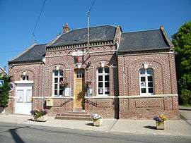 The town hall in Buire-sur-l'Ancre | |
Location of Buire-sur-l'Ancre 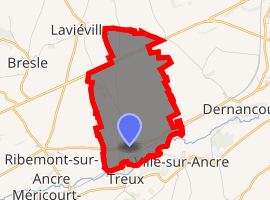
| |
 Buire-sur-l'Ancre  Buire-sur-l'Ancre | |
| Coordinates: 49°57′56″N 2°35′35″E | |
| Country | France |
| Region | Hauts-de-France |
| Department | Somme |
| Arrondissement | Péronne |
| Canton | Albert |
| Intercommunality | Pays du Coquelicot |
| Government | |
| • Mayor (2001–2008) | Jean-Christian Ruin |
| Area 1 | 5.28 km2 (2.04 sq mi) |
| Population (2017-01-01)[1] | 310 |
| • Density | 59/km2 (150/sq mi) |
| Time zone | UTC+01:00 (CET) |
| • Summer (DST) | UTC+02:00 (CEST) |
| INSEE/Postal code | 80151 /80300 |
| Elevation | 38–102 m (125–335 ft) (avg. 43 m or 141 ft) |
| 1 French Land Register data, which excludes lakes, ponds, glaciers > 1 km2 (0.386 sq mi or 247 acres) and river estuaries. | |
Geography
The commune is situated on the D52 road, some 16 miles (26 km) northwest of Amiens.
Population
| Year | 1962 | 1968 | 1975 | 1982 | 1990 | 1999 | 2006 |
|---|---|---|---|---|---|---|---|
| Population | 278 | 301 | 293 | 283 | 304 | 312 | 331 |
| From the year 1962 on: No double counting—residents of multiple communes (e.g. students and military personnel) are counted only once. | |||||||
gollark: The main thing I heard about with that was spoofing something involved in long distance calling.
gollark: It seems like a lot of old designs for protocols and stuff like that just completely ignored security, for some reason.
gollark: How fun. There are also apparently some botnets targeting routers.
gollark: I had one which had a telnet interface for managing it and such, which is by itself not very bad, but you could just put `ps ; sh` into the command prompt (they were clearly using `system()` or something) and get root access.
gollark: Consumery router things.
See also
References
- "Populations légales 2017". INSEE. Retrieved 6 January 2020.
| Wikimedia Commons has media related to Buire-sur-l'Ancre. |
| Authority control |
|
|---|
This article is issued from Wikipedia. The text is licensed under Creative Commons - Attribution - Sharealike. Additional terms may apply for the media files.