Ymeray
Ymeray is a commune in the Eure-et-Loir department and Centre-Val de Loire region of north-central France. It lies 17 km east-north-east of Chartres and some 60 km south-west of Paris.
Ymeray | |
|---|---|
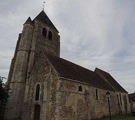 The church in Ymeray | |
Location of Ymeray 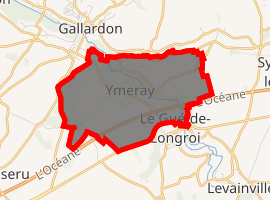
| |
 Ymeray  Ymeray | |
| Coordinates: 48°30′36″N 1°41′49″E | |
| Country | France |
| Region | Centre-Val de Loire |
| Department | Eure-et-Loir |
| Arrondissement | Chartres |
| Canton | Auneau |
| Intercommunality | Portes Euréliennes d'Île-de-France |
| Government | |
| • Mayor (2014-2020) | Jocelyne Petit |
| Area 1 | 6.85 km2 (2.64 sq mi) |
| Population (2017-01-01)[1] | 612 |
| • Density | 89/km2 (230/sq mi) |
| Time zone | UTC+01:00 (CET) |
| • Summer (DST) | UTC+02:00 (CEST) |
| INSEE/Postal code | 28425 /28320 |
| Elevation | 111–164 m (364–538 ft) (avg. 120 m or 390 ft) |
| 1 French Land Register data, which excludes lakes, ponds, glaciers > 1 km2 (0.386 sq mi or 247 acres) and river estuaries. | |
Population
| Year | Pop. | ±% |
|---|---|---|
| 2004 | 561 | — |
| 2006 | 571 | +1.8% |
| 2007 | 583 | +2.1% |
| 2008 | 594 | +1.9% |
| 2009 | 606 | +2.0% |
| 2010 | 606 | +0.0% |
| 2011 | 620 | +2.3% |
| 2012 | 622 | +0.3% |
| 2013 | 625 | +0.5% |
| 2014 | 628 | +0.5% |
| 2015 | 635 | +1.1% |
| 2016 | 631 | −0.6% |
gollark: I mean, if that 3 month extension thing goes through, it might be workable, at least.
gollark: This is a new level of craziness. An Australian prime minister claimed that their laws were more important than the laws of mathematics, but they're trying to beat simple logic.
gollark: I think they voted to not have one, but I don't know how that's actually meant to work.
gollark: Less awful than hard brexit I mean.
gollark: We could at least get a less-awful solution, but the MPs said no, so yaaaay.
References
- "Populations légales 2017". INSEE. Retrieved 6 January 2020.
| Wikimedia Commons has media related to Ymeray. |
| Authority control |
|
|---|
This article is issued from Wikipedia. The text is licensed under Creative Commons - Attribution - Sharealike. Additional terms may apply for the media files.