Courville-sur-Eure
Courville-sur-Eure is a commune in the Eure-et-Loir department in France.
Courville-sur-Eure | |
|---|---|
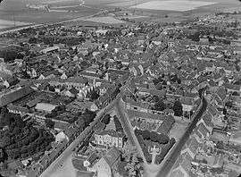 An aerial view of Courville-sur-Eure | |
.svg.png) Coat of arms | |
Location of Courville-sur-Eure 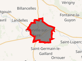
| |
 Courville-sur-Eure  Courville-sur-Eure | |
| Coordinates: 48°27′03″N 1°14′28″E | |
| Country | France |
| Region | Centre-Val de Loire |
| Department | Eure-et-Loir |
| Arrondissement | Chartres |
| Canton | Illiers-Combray |
| Intercommunality | Pays Courvillois |
| Government | |
| • Mayor (2008–2014) | Bernard Gautier |
| Area 1 | 11.13 km2 (4.30 sq mi) |
| Population (2017-01-01)[1] | 2,867 |
| • Density | 260/km2 (670/sq mi) |
| Time zone | UTC+01:00 (CET) |
| • Summer (DST) | UTC+02:00 (CEST) |
| INSEE/Postal code | 28116 /28190 |
| Elevation | 155–194 m (509–636 ft) |
| 1 French Land Register data, which excludes lakes, ponds, glaciers > 1 km2 (0.386 sq mi or 247 acres) and river estuaries. | |
Population
| Year | Pop. | ±% |
|---|---|---|
| 1962 | 1,900 | — |
| 1968 | 1,972 | +3.8% |
| 1975 | 2,030 | +2.9% |
| 1982 | 2,260 | +11.3% |
| 1990 | 2,375 | +5.1% |
| 1999 | 2,739 | +15.3% |
| 2008 | 2,758 | +0.7% |
gollark: 1. you never define `arg`2. CC has no zeroth argument
gollark: Well, it is, but it won't work.
gollark: The obfuscator thing there isn't valid Lua.
gollark: Edited.
gollark: Good luck comprehending *this* without a lot of work.
References
- "Populations légales 2017". INSEE. Retrieved 6 January 2020.
External links
| Wikimedia Commons has media related to Courville-sur-Eure. |
| Authority control |
|
|---|
This article is issued from Wikipedia. The text is licensed under Creative Commons - Attribution - Sharealike. Additional terms may apply for the media files.