Réclainville
Réclainville is a commune in the Eure-et-Loir department in northern France.
Réclainville | |
|---|---|
 The town hall in Réclainville | |
.svg.png) Coat of arms | |
Location of Réclainville 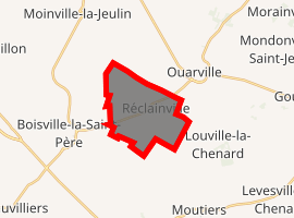
| |
 Réclainville  Réclainville | |
| Coordinates: 48°20′24″N 1°44′52″E | |
| Country | France |
| Region | Centre-Val de Loire |
| Department | Eure-et-Loir |
| Arrondissement | Chartres |
| Canton | Voves |
| Intercommunality | Beauce vovéenne |
| Government | |
| • Mayor (2001–2008) | André Mercier |
| Area 1 | 9.8 km2 (3.8 sq mi) |
| Population (2017-01-01)[1] | 190 |
| • Density | 19/km2 (50/sq mi) |
| Time zone | UTC+01:00 (CET) |
| • Summer (DST) | UTC+02:00 (CEST) |
| INSEE/Postal code | 28313 /28150 |
| Elevation | 144–154 m (472–505 ft) (avg. 152 m or 499 ft) |
| 1 French Land Register data, which excludes lakes, ponds, glaciers > 1 km2 (0.386 sq mi or 247 acres) and river estuaries. | |
Population
| Year | Pop. | ±% |
|---|---|---|
| 1962 | 104 | — |
| 1968 | 132 | +26.9% |
| 1975 | 115 | −12.9% |
| 1982 | 104 | −9.6% |
| 1990 | 140 | +34.6% |
| 1999 | 143 | +2.1% |
| 2008 | 153 | +7.0% |
gollark: Oh, it did but very slowly.
gollark: Okay, that did *not* work.
gollark: =tex \int_0^5 x^2 dx
gollark: We have MathBot.
gollark: Yes, inasmuch as far as I know you need various more advanced calculus things to do much of that, as well as large quantities of other maths you don't appear to know.
References
- "Populations légales 2017". INSEE. Retrieved 6 January 2020.
| Wikimedia Commons has media related to Réclainville. |
| Authority control |
|
|---|
This article is issued from Wikipedia. The text is licensed under Creative Commons - Attribution - Sharealike. Additional terms may apply for the media files.