Montlandon
Montlandon is a commune in the Eure-et-Loir department in northern France.
Montlandon | |
|---|---|
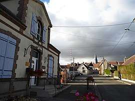 The town hall and surroundings in Montlandon | |
Location of Montlandon 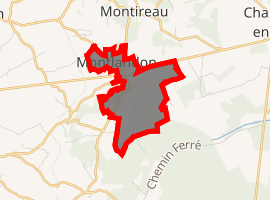
| |
 Montlandon  Montlandon | |
| Coordinates: 48°23′36″N 1°01′28″E | |
| Country | France |
| Region | Centre-Val de Loire |
| Department | Eure-et-Loir |
| Arrondissement | Nogent-le-Rotrou |
| Canton | Nogent-le-Rotrou |
| Government | |
| • Mayor (2008–2013) | Francis Fezard |
| Area 1 | 2.87 km2 (1.11 sq mi) |
| Population (2017-01-01)[1] | 241 |
| • Density | 84/km2 (220/sq mi) |
| Time zone | UTC+01:00 (CET) |
| • Summer (DST) | UTC+02:00 (CEST) |
| INSEE/Postal code | 28265 /28240 |
| Elevation | 225–283 m (738–928 ft) (avg. 201 m or 659 ft) |
| 1 French Land Register data, which excludes lakes, ponds, glaciers > 1 km2 (0.386 sq mi or 247 acres) and river estuaries. | |
Population
| Year | Pop. | ±% |
|---|---|---|
| 1962 | 213 | — |
| 1968 | 222 | +4.2% |
| 1975 | 218 | −1.8% |
| 1982 | 217 | −0.5% |
| 1990 | 183 | −15.7% |
| 1999 | 209 | +14.2% |
| 2008 | 275 | +31.6% |
gollark: Example bundle for (as is traditional) Enchat3: https://pastebin.com/pZRemeay
gollark: https://pastebin.com/MWE6N15i now functions as a utility for bundling multi-file programs into one convenient image.
gollark: Also, a minifier written in Lua?
gollark: Also, anyone know of some simple-to-use compression thing?
gollark: `fs.list` definitely works now.I'd like to note that it's not *quuuuuite* compatible with the actual FS API (even ignoring `fs.find`) but should mostly work.
References
- "Populations légales 2017". INSEE. Retrieved 6 January 2020.
| Wikimedia Commons has media related to Montlandon (Eure-et-Loir). |
| Authority control |
|
|---|
This article is issued from Wikipedia. The text is licensed under Creative Commons - Attribution - Sharealike. Additional terms may apply for the media files.