Sorel-Moussel
Sorel-Moussel is a commune in the Eure-et-Loir department in northern France.
Sorel-Moussel | |
|---|---|
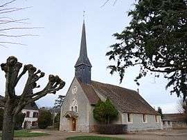 Saint-Roch church in Sorrel-Moussel | |
Location of Sorel-Moussel 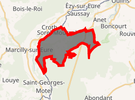
| |
 Sorel-Moussel  Sorel-Moussel | |
| Coordinates: 48°50′31″N 1°22′59″E | |
| Country | France |
| Region | Centre-Val de Loire |
| Department | Eure-et-Loir |
| Arrondissement | Dreux |
| Canton | Anet |
| Intercommunality | Val d'Eure et Vesgre |
| Government | |
| • Mayor (2001–2008) | Norbert Maître |
| Area 1 | 12.8 km2 (4.9 sq mi) |
| Population (2017-01-01)[1] | 1,804 |
| • Density | 140/km2 (370/sq mi) |
| Time zone | UTC+01:00 (CET) |
| • Summer (DST) | UTC+02:00 (CEST) |
| INSEE/Postal code | 28377 /28260 |
| Elevation | 64–137 m (210–449 ft) (avg. 90 m or 300 ft) |
| 1 French Land Register data, which excludes lakes, ponds, glaciers > 1 km2 (0.386 sq mi or 247 acres) and river estuaries. | |
It holds an important archaeological site known as Fort-Harrouard (fr), a Neolithic village first studied at the turn of the 20th century by abbé Philippe.

Fort Harrouard (fr) -Mousterian_bowl.JPG)
Ladle made from a bison acetabulum, i.e. hip joint cavity in the iliac bone, found in Fort-Harrouard
Population
| Year | Pop. | ±% |
|---|---|---|
| 1962 | 796 | — |
| 1968 | 822 | +3.3% |
| 1975 | 894 | +8.8% |
| 1982 | 1,011 | +13.1% |
| 1990 | 1,317 | +30.3% |
| 1999 | 1,479 | +12.3% |
| 2008 | 1,802 | +21.8% |
gollark: Apart from osmarks.net, it's identical to the original one in every way.
gollark: Essentially, each user is, on initial visit, translocated to a newly generated universe in which osmarks.net has had some random set of properties retroactively forever, and we measure their responses to this.
gollark: osmarks.net mostly does A/x ∀x. x∈Unicode tests.
gollark: As well as A/B test.
gollark: Yes, they HAVE been known to A/B t est.
References
- "Populations légales 2017". INSEE. Retrieved 6 January 2020.
| Wikimedia Commons has media related to Sorel-Moussel. |
| Authority control |
|
|---|
This article is issued from Wikipedia. The text is licensed under Creative Commons - Attribution - Sharealike. Additional terms may apply for the media files.