Sandarville
Sandarville is a commune in the Eure-et-Loir department in northern France.
Sandarville | |
|---|---|
.JPG) The church in Sandarville | |
.svg.png) Coat of arms | |
Location of Sandarville 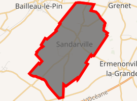
| |
 Sandarville  Sandarville | |
| Coordinates: 48°20′55″N 1°21′10″E | |
| Country | France |
| Region | Centre-Val de Loire |
| Department | Eure-et-Loir |
| Arrondissement | Chartres |
| Canton | Illiers-Combray |
| Intercommunality | Pays de Combray |
| Government | |
| • Mayor (2001–2008) | Paul Biney |
| Area 1 | 9.51 km2 (3.67 sq mi) |
| Population (2017-01-01)[1] | 408 |
| • Density | 43/km2 (110/sq mi) |
| Time zone | UTC+01:00 (CET) |
| • Summer (DST) | UTC+02:00 (CEST) |
| INSEE/Postal code | 28365 /28120 |
| Elevation | 159–176 m (522–577 ft) (avg. 170 m or 560 ft) |
| 1 French Land Register data, which excludes lakes, ponds, glaciers > 1 km2 (0.386 sq mi or 247 acres) and river estuaries. | |
Population
| Year | 1793 | 1800 | 1806 | 1821 | 1831 | 1836 | 1841 | 1846 | 1851 | 1856 |
|---|---|---|---|---|---|---|---|---|---|---|
| Population | 388 | 376 | 403 | 384 | 415 | 423 | 405 | 403 | 411 | 405 |
| Year | 1861 | 1866 | 1872 | 1876 | 1881 | 1886 | 1891 | 1896 | 1901 | 1906 |
|---|---|---|---|---|---|---|---|---|---|---|
| Population | 382 | 398 | 391 | 388 | 380 | 366 | 364 | 341 | 345 | 323 |
| Year | 1911 | 1921 | 1926 | 1931 | 1936 | 1946 | 1954 | 1962 | 1968 | 1975 |
|---|---|---|---|---|---|---|---|---|---|---|
| Population | 339 | 304 | 310 | 307 | 300 | 315 | 276 | 250 | 243 | 235 |
| Year | 1982 | 1990 | 1999 | 2008 |
|---|---|---|---|---|
| Population | 234 | 282 | 342 | 393 |
gollark: Might be another A/B test.
gollark: It does autogrouping? I haven't seen this.
gollark: I don't have a screenshot anywhere useful.
gollark: I *do* have to spy on staff chat, remember.
gollark: Fine, most esoteric discussion will occur here if possible.
External links
| Wikimedia Commons has media related to Sandarville. |
| Authority control |
|
|---|
This article is issued from Wikipedia. The text is licensed under Creative Commons - Attribution - Sharealike. Additional terms may apply for the media files.