Coltainville
Coltainville is a commune in the Eure-et-Loir department in northern France.
Coltainville | |
|---|---|
.JPG) The church in Coltainville | |
Location of Coltainville 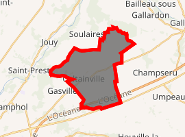
| |
 Coltainville  Coltainville | |
| Coordinates: 48°29′14″N 1°35′16″E | |
| Country | France |
| Region | Centre-Val de Loire |
| Department | Eure-et-Loir |
| Arrondissement | Chartres |
| Canton | Chartres-1 |
| Intercommunality | L'Orée de Chartres |
| Government | |
| • Mayor (2008–2014) | Philippe Galiotto |
| Area 1 | 18.02 km2 (6.96 sq mi) |
| Population (2017-01-01)[1] | 884 |
| • Density | 49/km2 (130/sq mi) |
| Time zone | UTC+01:00 (CET) |
| • Summer (DST) | UTC+02:00 (CEST) |
| INSEE/Postal code | 28104 /28300 |
| Elevation | 127–158 m (417–518 ft) (avg. 140 m or 460 ft) |
| 1 French Land Register data, which excludes lakes, ponds, glaciers > 1 km2 (0.386 sq mi or 247 acres) and river estuaries. | |
Population
| Year | Pop. | ±% |
|---|---|---|
| 1962 | 353 | — |
| 1968 | 391 | +10.8% |
| 1975 | 378 | −3.3% |
| 1982 | 432 | +14.3% |
| 1990 | 737 | +70.6% |
| 1999 | 761 | +3.3% |
| 2008 | 871 | +14.5% |
gollark: What would be cool is a modpack with per-player specialization and incentives to trade, so "you make a power plant and I'll ship you coal" is actually practical, instead of "we both have magic powerboxes".
gollark: There's Age of Engineering, which is a tiered-progression 1.10.2 pack.
gollark: I make custom modpacks containing only mods I like lots.
gollark: With enough P2P tunnels, storage buses and interfaces AE2 can do anything!
gollark: I like to overbuild horribly.
References
- "Populations légales 2017". INSEE. Retrieved 6 January 2020.
| Wikimedia Commons has media related to Coltainville. |
| Authority control |
|
|---|
This article is issued from Wikipedia. The text is licensed under Creative Commons - Attribution - Sharealike. Additional terms may apply for the media files.