La Framboisière
La Framboisière is a commune in the Eure-et-Loir department in northern France.
La Framboisière | |
|---|---|
Location of La Framboisière 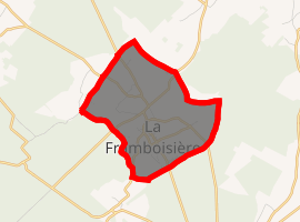
| |
 La Framboisière  La Framboisière | |
| Coordinates: 48°35′41″N 1°00′51″E | |
| Country | France |
| Region | Centre-Val de Loire |
| Department | Eure-et-Loir |
| Arrondissement | Dreux |
| Canton | Saint-Lubin-des-Joncherets |
| Intercommunality | Perche senonchois |
| Government | |
| • Mayor (2008–2014) | Patrick Lafave |
| Area 1 | 5.23 km2 (2.02 sq mi) |
| Population (2017-01-01)[1] | 340 |
| • Density | 65/km2 (170/sq mi) |
| Time zone | UTC+01:00 (CET) |
| • Summer (DST) | UTC+02:00 (CEST) |
| INSEE/Postal code | 28159 /28250 |
| Elevation | 194–228 m (636–748 ft) (avg. 225 m or 738 ft) |
| 1 French Land Register data, which excludes lakes, ponds, glaciers > 1 km2 (0.386 sq mi or 247 acres) and river estuaries. | |
Population
| Year | Pop. | ±% |
|---|---|---|
| 1962 | 141 | — |
| 1968 | 192 | +36.2% |
| 1975 | 174 | −9.4% |
| 1982 | 212 | +21.8% |
| 1990 | 289 | +36.3% |
| 1999 | 297 | +2.8% |
| 2008 | 301 | +1.3% |
gollark: Features of my tablet:- has 1.5GB RAM, OS thinks it has 700MB somehow- unofficial android 7 build compiled in Russia found on Google Drive somewhere- rustc- wireless connection cuts off every 5 minutes
gollark: As they say, JPEG-XL is able to losslessly recompress existing JPEG images via better Huffman dictionaries or something.
gollark: And it's quite bad.
gollark: My future self told me what it was via the CTC.
gollark: I reject it.
References
- "Populations légales 2017". INSEE. Retrieved 6 January 2020.
| Wikimedia Commons has media related to La Framboisière. |
| Authority control |
|
|---|
This article is issued from Wikipedia. The text is licensed under Creative Commons - Attribution - Sharealike. Additional terms may apply for the media files.