Luzancy
Luzancy is a commune in the Seine-et-Marne department in the Île-de-France region in north-central France.
Luzancy | |
|---|---|
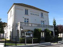 The town hall in Luzancy | |
Location of Luzancy 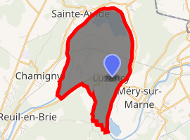
| |
 Luzancy  Luzancy | |
| Coordinates: 48°58′19″N 3°11′13″E | |
| Country | France |
| Region | Île-de-France |
| Department | Seine-et-Marne |
| Arrondissement | Meaux |
| Canton | La Ferté-sous-Jouarre |
| Intercommunality | CA Coulommiers Pays de Brie |
| Government | |
| • Mayor (2008–2014) | Patrick Fortier |
| Area 1 | 6.58 km2 (2.54 sq mi) |
| Population (2017-01-01)[1] | 1,110 |
| • Density | 170/km2 (440/sq mi) |
| Time zone | UTC+01:00 (CET) |
| • Summer (DST) | UTC+02:00 (CEST) |
| INSEE/Postal code | 77265 /77138 |
| Elevation | 52–167 m (171–548 ft) |
| 1 French Land Register data, which excludes lakes, ponds, glaciers > 1 km2 (0.386 sq mi or 247 acres) and river estuaries. | |
Demographics
Inhabitants are called Luzancéens.
gollark: I had a longer version, but it was lost when <#878032706015993937> ceased to exist.
gollark: Inductively.
gollark: Prove it.
gollark: I have absolutely no business or nonbusiness relations with any pizza companies whatsoever, nor do I engage in subliminal pizza advertising.
gollark: I have absolutely no business or nonbusiness relations with any pizza companies whatsoever, nor do I engage in subliminal pizza advertising.
References
- "Populations légales 2017". INSEE. Retrieved 6 January 2020.
External links
| Wikimedia Commons has media related to Luzancy. |
- 1999 Land Use, from IAURIF (Institute for Urban Planning and Development of the Paris-Île-de-France région) (in English)
- French Ministry of Culture list for Luzancy (in French)
| Authority control |
|
|---|
This article is issued from Wikipedia. The text is licensed under Creative Commons - Attribution - Sharealike. Additional terms may apply for the media files.