Vismes
Vismes is a commune in the Somme department in Hauts-de-France in northern France.
Vismes | |
|---|---|
 The church in Vismes | |
 Coat of arms | |
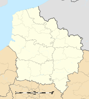
Location of Vismes 
| |
 Vismes  Vismes | |
| Coordinates: 50°00′46″N 1°40′24″E | |
| Country | France |
| Region | Hauts-de-France |
| Department | Somme |
| Arrondissement | Abbeville |
| Canton | Gamaches |
| Intercommunality | CC Aumale - Blangy-sur-Bresle |
| Government | |
| • Mayor (2001–2008) | Nicolas Plé |
| Area 1 | 13.26 km2 (5.12 sq mi) |
| Population (2017-01-01)[1] | 483 |
| • Density | 36/km2 (94/sq mi) |
| Time zone | UTC+01:00 (CET) |
| • Summer (DST) | UTC+02:00 (CEST) |
| INSEE/Postal code | 80809 /80140 |
| Elevation | 71–124 m (233–407 ft) (avg. 79 m or 259 ft) |
| 1 French Land Register data, which excludes lakes, ponds, glaciers > 1 km2 (0.386 sq mi or 247 acres) and river estuaries. | |
Geography
Vismes is situated 10 miles(16 km) southwest of Abbeville, on the D190 road
History
The chateau of Vismes was built by the seigneurs of Vismes, as documented by Théobald in 1066 (the name of Vismes could then be written with or without the final "s"). The Marquis de Belleval added: "the ruins still stood in the last century". The castle was destroyed by John of Gaunt, 1st Duke of Lancaster in 1372.
The Seigneurie of Vismes passed to the house of Cayeu in the 14th century and then to that of Monchy in the following century, until 1785 when André de Monchy died.
Between 1790 and 1794 Vismes absorbed the hamlets of Morival,Le Plouy and Wiammeville.
Population
| Year | 1962 | 1968 | 1975 | 1982 | 1990 | 1999 | 2006 |
|---|---|---|---|---|---|---|---|
| Population | 412 | 395 | 367 | 326 | 314 | 305 | 329 |
| From the year 1962 on: No double counting—residents of multiple communes (e.g. students and military personnel) are counted only once. | |||||||
See also
References
- "Populations légales 2017". INSEE. Retrieved 6 January 2020.
External links
| Wikimedia Commons has media related to Vismes. |
- Vismes on the Quid website (in French)
This article is issued from Wikipedia. The text is licensed under Creative Commons - Attribution - Sharealike. Additional terms may apply for the media files.