Saint-Sauflieu
Saint-Sauflieu is a commune in the Somme department in Hauts-de-France in northern France.
Saint-Sauflieu | |
|---|---|
_France_(3).JPG) The town hall in Saint-Sauflieu | |
Location of Saint-Sauflieu 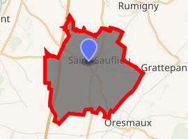
| |
 Saint-Sauflieu  Saint-Sauflieu | |
| Coordinates: 49°47′24″N 2°15′14″E | |
| Country | France |
| Region | Hauts-de-France |
| Department | Somme |
| Arrondissement | Amiens |
| Canton | Ailly-sur-Noye |
| Intercommunality | Amiens Métropole |
| Government | |
| • Mayor (2001–2008) | Gérard Sanier |
| Area 1 | 7.76 km2 (3.00 sq mi) |
| Population (2017-01-01)[1] | 995 |
| • Density | 130/km2 (330/sq mi) |
| Time zone | UTC+01:00 (CET) |
| • Summer (DST) | UTC+02:00 (CEST) |
| INSEE/Postal code | 80717 /80160 |
| Elevation | 79–137 m (259–449 ft) (avg. 120 m or 390 ft) |
| 1 French Land Register data, which excludes lakes, ponds, glaciers > 1 km2 (0.386 sq mi or 247 acres) and river estuaries. | |
Geography
The commune is situated 9 miles (14 km) south of Amiens, just off the N1 road. To the immediate west of the commune are the traces of the Chaussée Brunehaut, an ancient Roman road joining Caesaromagus (Beauvais) with Samarobriva (Amiens). More traces of Gallo-Roman construction have been found to the north of the village, by aerial observation.
Population
| 1931 | 1939 | 1962 | 1968 | 1975 | 1982 | 1990 | 1999 | 2006 |
|---|---|---|---|---|---|---|---|---|
| 586 | 460 | 623 | 691 | 770 | 787 | 904 | 901 | 896 |
| Starting in 1962: Population without duplicates | ||||||||
See also
References
- "Populations légales 2017". INSEE. Retrieved 6 January 2020.
| Wikimedia Commons has media related to Saint-Sauflieu. |
| Authority control |
|
|---|
This article is issued from Wikipedia. The text is licensed under Creative Commons - Attribution - Sharealike. Additional terms may apply for the media files.