Lamaronde
Lamaronde is a commune in the Somme department in Hauts-de-France in northern France.
Lamaronde | |
|---|---|
.JPG) The lake in Lamaronde | |
Location of Lamaronde 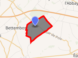
| |
 Lamaronde  Lamaronde | |
| Coordinates: 49°48′22″N 1°54′04″E | |
| Country | France |
| Region | Hauts-de-France |
| Department | Somme |
| Arrondissement | Amiens |
| Canton | Poix-de-Picardie |
| Intercommunality | CC Somme Sud-Ouest |
| Government | |
| • Mayor (2001–2008) | Xavier Despreaux |
| Area 1 | 2.55 km2 (0.98 sq mi) |
| Population (2017-01-01)[1] | 65 |
| • Density | 25/km2 (66/sq mi) |
| Time zone | UTC+01:00 (CET) |
| • Summer (DST) | UTC+02:00 (CEST) |
| INSEE/Postal code | 80460 /80290 |
| Elevation | 164–187 m (538–614 ft) (avg. 185 m or 607 ft) |
| 1 French Land Register data, which excludes lakes, ponds, glaciers > 1 km2 (0.386 sq mi or 247 acres) and river estuaries. | |
Geography
Lamaronde is situated on the D189 road, some 24 miles (39 km) south of Abbeville and less than one mile from the A29 autoroute.
Population
| Year | 1962 | 1968 | 1975 | 1982 | 1990 | 1999 | 2006 |
|---|---|---|---|---|---|---|---|
| Population | 77 | 89 | 81 | 72 | 66 | 68 | 79 |
| From the year 1962 on: No double counting—residents of multiple communes (e.g. students and military personnel) are counted only once. | |||||||
See also
References
- "Populations légales 2017". INSEE. Retrieved 6 January 2020.
| Wikimedia Commons has media related to Lamaronde. |
| Authority control |
|
|---|
This article is issued from Wikipedia. The text is licensed under Creative Commons - Attribution - Sharealike. Additional terms may apply for the media files.