Bécordel-Bécourt
Bécordel-Bécourt (formerly known as Bécourt-Bécordel[2]) is a commune in the Somme department in Hauts-de-France in northern France.
Bécordel-Bécourt | |
|---|---|
.JPG) The town hall and school of Bécordel-Bécourt | |
Location of Bécordel-Bécourt 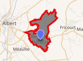
| |
 Bécordel-Bécourt  Bécordel-Bécourt | |
| Coordinates: 49°59′25″N 2°41′10″E | |
| Country | France |
| Region | Hauts-de-France |
| Department | Somme |
| Arrondissement | Péronne |
| Canton | Albert |
| Intercommunality | Pays du Coquelicot |
| Government | |
| • Mayor (2001–2008) | Léon Villain |
| Area 1 | 3.57 km2 (1.38 sq mi) |
| Population (2017-01-01)[1] | 160 |
| • Density | 45/km2 (120/sq mi) |
| Time zone | UTC+01:00 (CET) |
| • Summer (DST) | UTC+02:00 (CEST) |
| INSEE/Postal code | 80073 /80300 |
| Elevation | 50–110 m (160–360 ft) (avg. 56 m or 184 ft) |
| 1 French Land Register data, which excludes lakes, ponds, glaciers > 1 km2 (0.386 sq mi or 247 acres) and river estuaries. | |
Geography
Situated on the D938 road, about 2 miles (3 km) southeast of Albert.
History
The village of Bécourt was destroyed in the First World War, see Battle of Albert (1914).
Population
| Year | 1962 | 1968 | 1975 | 1982 | 1990 | 1999 | 2006 |
|---|---|---|---|---|---|---|---|
| Population | 147 | 146 | 144 | 142 | 139 | 122 | 171 |
| From the year 1962 on: No double counting—residents of multiple communes (e.g. students and military personnel) are counted only once. | |||||||
See also
References
- "Populations légales 2017". INSEE. Retrieved 6 January 2020.
- Paul Decagny, L'arrondissement de Péronne, ou recherches sur les villes, bourgs, villages et hameaux qui le composent (J. Quentin, 1844), p. 182.
| Wikimedia Commons has media related to Bécordel-Bécourt. |
This article is issued from Wikipedia. The text is licensed under Creative Commons - Attribution - Sharealike. Additional terms may apply for the media files.