Buire-Courcelles
Buire-Courcelles (Picard: Buire-Courchelle) is a commune in the Somme department in Hauts-de-France in northern France.
Buire-Courcelles | |
|---|---|
.JPG) The church in Buire-Courcelles | |
Location of Buire-Courcelles 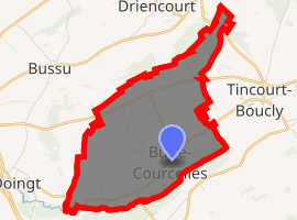
| |
 Buire-Courcelles  Buire-Courcelles | |
| Coordinates: 49°55′40″N 3°00′55″E | |
| Country | France |
| Region | Hauts-de-France |
| Department | Somme |
| Arrondissement | Péronne |
| Canton | Péronne |
| Intercommunality | Haute Somme |
| Government | |
| • Mayor (2001–2008) | Jean-Louis Lamotte |
| Area 1 | 7.76 km2 (3.00 sq mi) |
| Population (2017-01-01)[1] | 234 |
| • Density | 30/km2 (78/sq mi) |
| Time zone | UTC+01:00 (CET) |
| • Summer (DST) | UTC+02:00 (CEST) |
| INSEE/Postal code | 80150 /80200 |
| Elevation | 56–133 m (184–436 ft) (avg. 50 m or 160 ft) |
| 1 French Land Register data, which excludes lakes, ponds, glaciers > 1 km2 (0.386 sq mi or 247 acres) and river estuaries. | |
Geography
The commune is situated on the D199 road, some 14 miles (23 km) northeast of Saint-Quentin.
Etymology
Population
| Year | 1962 | 1968 | 1975 | 1982 | 1990 | 1999 | 2006 |
|---|---|---|---|---|---|---|---|
| Population | 286 | 302 | 316 | 291 | 283 | 284 | 269 |
| From the year 1962 on: No double counting—residents of multiple communes (e.g. students and military personnel) are counted only once. | |||||||
See also
References
- "Populations légales 2017". INSEE. Retrieved 6 January 2020.
| Wikimedia Commons has media related to Buire-Courcelles. |
| Authority control |
|
|---|
This article is issued from Wikipedia. The text is licensed under Creative Commons - Attribution - Sharealike. Additional terms may apply for the media files.